NavPlay app for boaters
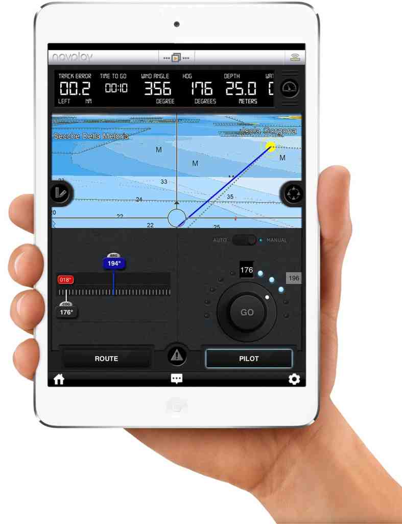
Words with Friends is cool, but a new app called NavPlay lets boaters use iPads to plan routes and navigate using C-Map charts and satellite imagery along with Wi-Fi-networked vessel information including alarms, autopilot and AIS.
The app is designed for boats up to 55 feet LOA. With the swipe of a finger, skippers can create or modify a full route complete with waypoints. The app automatically downloads Jeppesen weather forecast data to help with planning. Underway, the iPad will display navigation charts with customizable gauges, and the app can automatically send commands to the boat’s autopilot.
“We developed NavPlay for the Apple iPad to provide boaters with advanced planning and navigation capabilities as well as the ability to easily share their excursions with family and friends,” NavPlay sales and marketing manager Andrea Buralli stated in a press release. “No other navigation app has tools and features dedicated to the combined user navigation and social media experience.”
The app is compatible with iPad2, iPad3, iPad4, iPad Mini and iPad Air models with Wi-Fi running iOS 6.0 or newer. Available languages are English, Italian, French and German.
The introductory app can be downloaded from the Apple Store for $4.99 with 15 days of free access to all navigation features. A one-year subscription is $49.99.
Learn more at www.navplay.com.


