

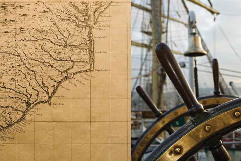
Compass and Chart
In 1981, Capt. Henry Marx was paralleling the coast of El Salvador on a yacht delivery from San Francisco to Connecticut. There were warnings to stand 40 miles offshore courtesy of the Salvadoran Civil War, but he was unsure of his vessel’s exact location. Without a Loran unit and after two days of persistent cloud cover, it was near impossible to derive a solid fix. As the owner of Connecticut-based Landfall Navigation and a longtime Safety at Sea Symposium instructor, Marx knew his way around yachts. Maybe that’s why the idea hit him as he was listening to Radio Managua on a portable radio.
He swung the radio until he lost the signal, then kept rotating until he regained reception. By averaging these two bearings, Marx derived his bearing to the radio antenna, which he charted along with a time stamp. Thirty minutes later, he found a station out of San Jose, Costa Rica, and repeated his process.
“When I told my navigator that I knew where we were, he asked if I also had a bridge that I wanted to sell!” Marx recalls. The next afternoon, however, the Gulf of Fonseca moved into view right on time, confirming Marx’s dead reckoning. “I was off by 3 miles, but it was close enough.”
Modern mariners live in privileged times, thanks to satellite navigation and electronic instrumentation, but humans have been navigating the high seas since long before we harnessed electricity. Here’s how we did it.
SPEEDOS
Along with chronometers and sextants, speedos are one of the most important navigation instruments, yet electronic speedometers weren’t available until the 1950s. Instead, mariners built chip logs consisting of a wooden log attached to a “log line” with evenly spaced knots that was spooled off a reel. To estimate speed, a sailor deployed the log overboard and counted how many knots passed through his hands in a specific interval, originally measured by an hourglass.
Next came mechanical odometers called taffrail logs, which are still available. These consist of a torpedo-shaped rotator with spin-inducing fins attached to a section of log line, as well as a stern-mounted register that records how far the boat has traveled. By dividing the distance traveled by the time required to cover this ground, a navigator can determine the boat’s average speed.
“If you had any kind of current set, it really screwed up the numbers,” Marx says. “It was considerably less than perfect, but you got to know your boat pretty well. You’d use the clock a lot. You’d measure the distance and the heading to your target, you’d estimate your speed, you’d have an ETA, and — shortly before [your ETA] — you’d worry.”
SOUNDERS
Modern boaters benefit from electronic depth sounders and sonar, but traditional mariners relied on slow speeds, lead lines, dinghies and their eyes to avoid finding the bricks. Lead lines, aka sounding lines, have been widely employed for millennia and are still used by some mariners, Marx included, today. These simple devices consist of a plumb bob, typically lead, with a becket on one end — allowing it to be attached to the sounding line — and a divot at the other end that’s packed with paraffin. A “leadsman” stands forward, next to the headstay, and casts the lead line ahead of his vessel. The sounding line is typically adorned with markers, much like some modern anchor rodes, that indicate how many fathoms of water reside below the water’s surface. Paraffin is added to bring up a bottom sample, allowing sailors to determine the bottom structure (e.g., mud, sand or rock), which can be cross-referenced with their charts.
When waters get tight, careful mariners send their dinghy, equipped with the log line, ahead and follow loosely astern with the big boat. Some sailors become experts at reading the water. “You can tell by the shape of the wave how deep the water is,” Marx says. “The shallower the water, the steeper the waves. It’s not precise, but it gives you an idea.”
RADAR
“We saw radar on other people’s boats in the 1950s, but that was about it,” says Jim Jessie, 83. He is a liveaboard yachtsman from Alameda, California, who has been actively boating for 74 years, racking up 250,000 miles including a circumnavigation — sans radar or GPS. He also completed 10 Transpacific Yacht races. “So we’d stop sailing every few minutes without luffing our sails and use our five senses,” he says. “Paying attention was important.”
Jessie mentioned using a system of bells and whistles, but these are only effective if the lurking danger is another manned vessel. “We had our close calls,” Jessie recalls of a fog-choked Downeast cruise when his bowman reported hearing breaking surf. “I immediately swung the helm and, looking over my shoulder, I saw a rock the size of my boat, 50 feet away.”
To cope, mariners sounded foghorns and listened for echoes. “Keeping a good lookout and a good listen out, those were the main things,” says Jessie, who advised that keeping watch inside a canvas-covered cockpit or an enclosed helm during nasty weather didn’t work because he couldn’t hear. “There weren’t that many incidents,” Jessie says. “But there weren’t so many boats out there back then either.”

CARTOGRAPHY
“With printed charts, the accuracy and the features [for most cruising grounds] haven’t changed in more than 50 years,” Marx says. “I have a fabulous chart from the 1800s — all the buoys are on it, although the soundings aren’t quite as precise [as modern charts].” The reason old charts are still decently accurate, especially in areas with stable bottom structures, is that the United Kingdom Hydrographic Office began survey work in the late 1700s. By the 1800s, it was producing high-quality bathymetry that still serves as the base map for many modern charts.
The problem, of course, is that updates were only periodically available. Trouble arose when storms rearranged unstable bottom structures and rendered charts obsolete.
“You’d update your charts from people that you met cruising,” says Jessie, who traded charts with other long-distance cruisers, comparing editions and making hand-drawn edits to his library.
“If we were going to a far-off place, I’d draw a 10-mile circle around dangerous things, and you made a list of the mountains and [geographical features] that you’d see as you’d approach,” Jessie says. “It was all eyeball stuff. You spent your life clutching a hand-bearing compass.”
VHF RADIOS
“There was no way to communicate off the boat when I was a kid, except to swim to shore with a dime and find a pay phone,” Jessie says of post-World War II cruising. “If you got yourself into trouble, you had to get yourself out of trouble.”
While ancient mariners devised elaborate communication schemes — including the International Code of Signals, signaling lights, and horns and whistles — these were short-range solutions that could easily be rendered useless by nightfall or environmental and meteorological conditions. High-frequency, single- and double-sideband radios followed, but these were notoriously difficult to operate. Until VHF’s arrival in the early 1970s, these were simply the available technologies, and even first-generation VHFs didn’t entirely ameliorate the situation.
“You needed a crystal to transmit and another to receive,” says Chuck Hawley, a US Sailing Safety at Sea Committee chairman and West Marine’s former vice president of product information. He explains that early generation VHFs were typically limited to about 12 channels, with five that came factory-installed; mariners added channel capacity by adding crystal sets. “A radio might have cost $350,” says Hawley, “but it rapidly went up to $500 or $600 with the extra crystals.”
Thankfully, the first all-synthesized VHF-FM radio arrived in the late ’70s and offered all 55 marine VHF channels, sans additional crystals. Miniaturization followed, including contemporary VHF handhelds.
“Today’s navigator enjoys an unbelievable array of electronics that make his job more accurate, safer and easier, assuming everything works properly and he has not become complacent,” Marx says. “But when things go wrong at sea, it’s critical that the navigator has the traditional navigation skills to do [things] the old-fashioned way.”
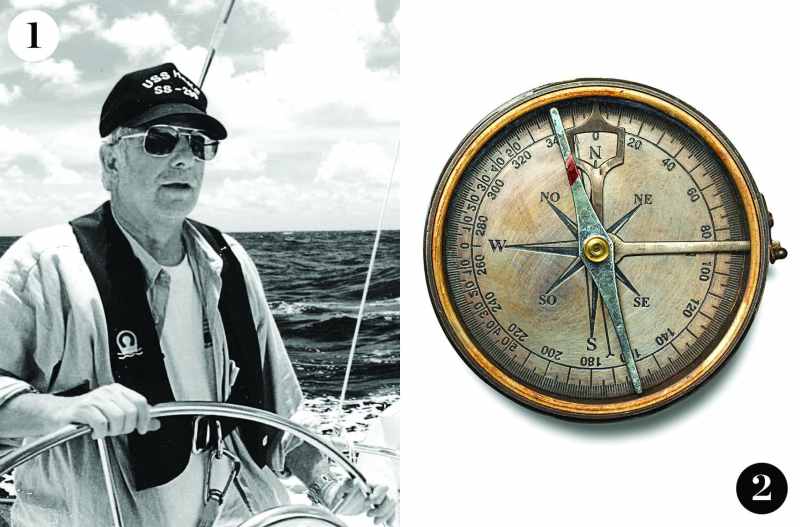
1. Traditional Solutions
Collisions and fog are age-old problems that were traditionally tackled with good seamanship and a few tricks. For example, yachtsman Jim Jessie always hung a 90-degree turn after departing a harbor; he then held course for an hour before assuming a rhumb line to his destination so that he could escape heavily trafficked lanes. And while finding buoys in the fog can be tough, especially when dead reckoning and current are involved, longtime Capt. Henry Marx recalls arriving at a Downeast waypoint and, when the buoy wasn’t visible, spinning wave-inducing circles before hearing the bell. “The lucky guys are still here,” says Marx, “but the dumb guys aren’t.”
2. Old-School
Navigators such as Jim Jessie, who circumnavigated sans GPS or other modern electronics, would commonly carry a small hand-bearing compass with them, especially as they got close to making landfall. Careful modern navigators are wise to do the same.


