This is a tale of two GPS units: the Magellan MAP 330 and the Lowrance GlobalMap 100. This, however, is not a one-on-one comparison; that would be like comparing pineapples with coconuts (field test venue: Caribbean Sea).
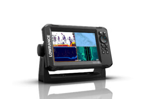
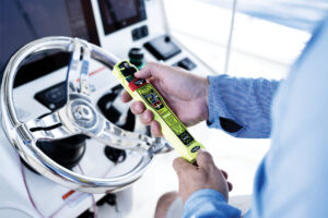
The Magellan is a lightweight, shirt-pocket model, best suited for backup or dinghy use. The Lowrance is handheld, too, but with real heft. With optional bracket mount, it could well serve as the primary GPS for a small yacht.
It was great to finally get these two aboard my boat after the awful foreplay ashore. Both units have a mini-plotter function, allowing the user to download detailed charts from a PC. Trouble was, both units have a nine-pin serial connection on the data cables, while my new laptop has USB ports.
Neither Magellan nor Lowrance addressed this possibility in their manuals, even though USB ports are increasingly common, especially on laptops. I spent a couple hours looking for adapters. I tried a Palm Pilot adapter, but it would not let my PC and GPS talk. Then I spent $119 for a port replicator, which eventually solved 50 percent of the problem.
I was able to download Magellan’s MapSend Streets info on CD-ROM from my laptop, but the Lowrance unit balked. Perhaps it did not like the Windows Millennium operating software. I was finally able to download Lowrance’s MapCreate software from a friend’s PC, running Windows 95.
I wasn’t feeling very user-friendly when I conducted my first assault. “What do you expect people who buy your products to do?” I asked Magellan’s hapless spokesperson. “Buy a different computer because Magellan doesn’t offer USB connections?”
A few days later, Angela Linsey-Jackson of Magellan called me back. Technical staffers had assured her they were looking at a USB cable option, though it would mean an added consumer cost.
Let us return to the Caribbean and the field test. In Salinas, Puerto Rico, I jury-rigged the Lowrance in the cockpit near the starboard steering station. I secured the Magellan to the chart table below.
En route to St. Thomas, both units worked well. The Lowrance let me select a navigation mode with numbers big enough to read from the tiller 5 feet away, even in harsh tropical sunlight. Also good was this unit’s compass mode (something not featured on the ship’s own GPS) because it responded quickly to course alterations despite our slow, 5-knot cruising speed.
Belowdecks, I got a surprise. The Magellan was happily reporting our progress despite nearly an inch of plywood and fiberglass between its tiny antenna and the sky. The ship’s own GPS had never been able get a good grip on those signals from down below.
I brought the Lowrance down for the party. She, too, tracked like a champ. That gave me an idea: Let’s push these units’ tracking qualities to the limit on the fiord-like avenues of lower Manhattan on the way to the New York Boat Show.
Several Yachting staffers and I sat in the back of a cab on a course, however indirect, to the Jacob Javits Center. I fiddled with the two GPS units. Each continued to track enough satellites to display our cab’s progress.
At sea, I would not rely on this mapping feature to enter a strange harbor, but it is sufficient for what contributing editor Chuck Husick calls “situational awareness.” On a night cruise, for example, the GPS maps might quickly answer the question of whether those lights along the Connecticut shoreline are Norwalk or Bridgeport.
After the New York Boat Show, I discussed my USB concerns with Lowrance Public Relations Manager Steve Wegrzyn. He said the current crop of Lowrance products is not USB friendly, though a hardware interface is being developed.
“The GlobalMap does not have it (a USB option) and won’t have it, probably because it’s reaching the plateau of its life cycle on the market,” he said.
My Windows Millennium problem was just that-my problem. Wegrzyn said Lowrance technicians can download maps into the Lowrance.
Overall, both units are good and include all the capabilities we have come to expect in a GPS. But if downloaded mapping is important, check hardware compatibility.
Lowrance GlobalMap 100 price: $209. Lowrance, (918) 438-8616; www.lowrance.com.
Magellan Map 330 price: $249. Magellan Corporation, (909) 396-5000; www.magellangps.com.

