
My first trip through deception pass unfurled at almost 40 knots and likely shaved off some years of my life. This aptly named pass separates the northern reaches of Washington state’s Whidbey Island from Fidalgo Island’s southern shores and is home to underwater rocks, strong currents and an often-piping wind. Fortunately, our skipper threaded the needle just so, but this didn’t stop me from silently wishing for a powerful forward-looking sonar that would buy him significantly better situational awareness and greater reaction time than our bow-mounted lookout (me) could afford.
Now, nine years later, FarSounder’s Argos 350 system stands ready to help yachtsmen thread all sorts of nautical needles (but still not at 40 knots).
The desire to peer beneath the waves ahead of one’s vessel is ancient and obvious, and it’s one that modern technology is enabling. Much like a regular sonar, forward-looking sonar transmits acoustic energy (pings) through the water, except the transducers face forward. Given the nature of sound propagation, these pings also reflect off the ocean’s bottom, giving users information about objects in the water column and about the upcoming seafloor.
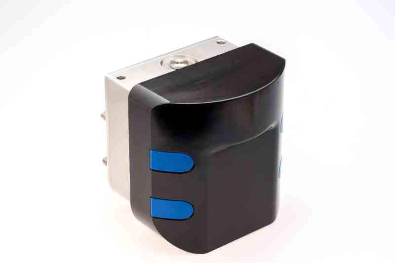
FarSounder has long offered forward-looking-sonar products, but its Argos 350 system brings exploration-level sonar to the leisure-marine market. It gives owners of displacement and semidisplacement yachts from about 60 to 130 feet length overall greater situational awareness and collision-avoidance information. It works at a range of up to 1,150 feet and at speeds up to 18 knots in open waters.
The Argos 350 system (call for pricing) employs a transducer module, a power module, custom and Ethernet cabling, a processing computer, and FarSounder’s SonaSoft software. The gear delivers FLS imagery to the yacht’s Ethernet network, allowing it to be viewed on third-party-compatible displays. Additionally, FarSounder’s software-developer kit allows some third-party equipment, such as an autopilot, to leverage the information.
Like all FLS, the Argos 350 has range that’s limited by the laws of physics when it comes to bottom mapping, however, these limitations are fewer when it comes to detecting water-column dangers.
“Our systems see eight times the water depth in front of the vessel—and often more—for bottom mapping, but they can also see out to the system’s full range for detecting obstacles in the water column,” says Cheryl M. Zimmerman, FarSounder’s CEO. “It’s able to show the distance to the obstacle, but not its depth, until the yacht comes into the bottom-mapping range. Our system ensonifies the whole volume and then reflects these soundings back to the transducer module via thousands of beams, and [they are] then sent to the processing computer.”
To skirt range-limiting issues such as signal interference, shallow-water operation, surface effects and vessel motion, Argos systems’ hardware and software collect and process FLS data in three dimensions.
“Without 3D capability, FLS are unable to easily compensate for roll and pitch without large amounts of expensive hardware,” Zimmerman says. “Even then, 2D roll-and-pitch compensation is marginal at best. FarSounder’s technology is capable of compensating for roll and pitch entirely in software in conjunction with an advanced sensor. All Argos systems have fast refresh rates and deliver a wide field of view with every single ping, and each deal with multipath and water-depth challenges.”
Once installed, the Argos 350 system delivers a 90-degree field of view out to 1,150 feet and typically displays this information as a split screen, with one side showing the vessel and its FLS cone overlaid atop cartography. The other side depicts a large 3D rendering and a smaller 2D rendering of the same scene. Additionally, the system displays heading, GPS data, and course- and speed-over-ground information.
And should an Argos system detect a threat, it’s not reticent.
“There’s an audible and/or visual alarm system that is user-defined,” Zimmerman says, adding that users can set warning parameters such as maximum and minimum ranges and depths. “One important parameter involves setting the sensitivity of the system alarm, with the user determining how many pings should be detected before setting off the alarm, in order to minimize false alarms.”
The system uses color coding to draw a user’s attention to loud—or dense—objects. “We offer both color coding that’s matched to signal strength, which refers to how ‘loud’ an object is, as well as color coding that’s mapped to depth,” Zimmerman says. “A multicolor, uniform luminance gradient color map is used to indicate depth, while an orange-copper color map is used to indicate signal level. The operator can switch between signal strength and depth, depending on their needs.”
This setup gives navigators an at-a-glance way to differentiate between the seafloor and dangerous water-column targets and—for gunkholing or exploration—a way to determine if there’s enough water to safely proceed.
Conveniently, the setup also helps to determine where to throw hooks, both large and small. “For finding a good anchorage, you may want to look at the signal strength in order to determine the bottom composition,” Zimmerman says. Anglers can also leverage this information to identify fish habitats.
An Argos 350 system does have limitations. Given that the maximum range for full bottom mapping and FLS capabilities is 1,150 feet, or approximately one-fifth of a nautical mile, and given that the maximum safe navigable speed in open water is 18 knots, an Argos 350 system will provide up to 38 seconds of warning at 18 knots before a vessel strikes calamity.
Granted, 38 seconds isn’t much time to let a skipper react, but the cost-free solution to that problem involves throttle discretion.
“In areas of ice and other potential hazards, I would advise a [to] yacht slow down and operate in a cautious manner,” Zimmerman says. At 12 knots, a yacht would ply the same waters in 57 seconds, while cutting speed to 5 knots would deliver 2 minutes, 16 seconds of reaction time.
So, while a yet-to-be-invented Argos 350 system would have quelled my fears the first time I transited Deception Pass, our skipper still would have needed to exercise some throttle discretion to leverage the safety margin the system affords.
And that latter bit, of course, is a whole different story.
New Electronics
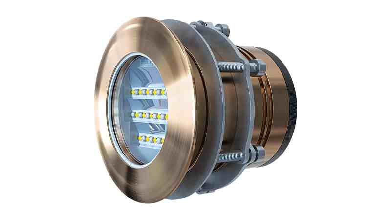
OceanLED’s E7 (call for pricing) underwater light kicks out up to 11,000 lumens and comes in two color schemes: midnight blue/ultra-white or multicolor. E7 lights have a 90-degree top beam and 20-degree side beam, and are available with 10- to 50-degree angle options. Additional features include strobe-light mode, dynamic-audio mode, a rectangular beam pattern and multiple controller types. Check it out, at oceanled.com.
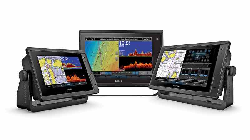
Garmin’s line of GPSMap Plus multifunction displays are available with 7-, 9- and 12-inch screens ($900 to $2,900) and have full navigational capabilities. They also have much deeper engine integration than standard MFDs thanks to J1939 connectivity. GPSMap Plus MFDs also deliver Garmin’s OneHelm compatibility, which brings control of third-party systems onto the MFD’s user-friendly interface. Check it out, at garmin.com.
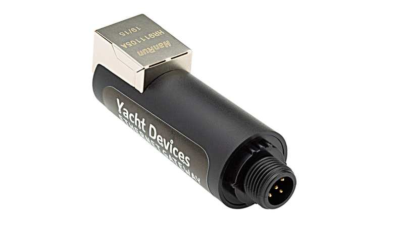
Navigating on a personal computer requires a gateway device so the PC can access a yacht’s NMEA 0183 and/or NMEA 2000 networks. Yacht Devices’ NMEA 2000 Ethernet Gateway ($190) gives third-party navigation and routing-software access to, for example, AIS data. It’s easily configured and updated via a built-in web server. Ethernet connectivity ensures compatibility with NMEA’s OneNet protocol. Check it out, at yachtd.com.


