Great Barrier Reef
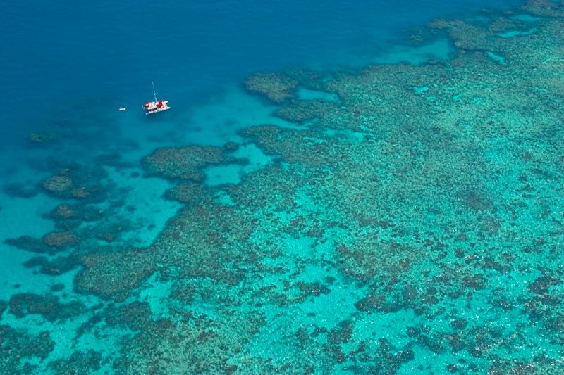
In the spring of 1998, my family and I chartered a boat for a week of cruising Australia’s Whitsunday Islands and snorkeling on the Great Barrier Reef. While the boating was world class, one nightly challenge involved finding sandy holding ground to avoid damaging coral heads with our anchor. Some areas, such as Hamilton Island, had designated anchoring zones. Other anchorages were less restricted. We learned to use our snorkeling gear to find suitable spots, but this could be dodgy (read: sharks) if we arrived around sunset.
Fortunately 3-D down-scan sonar has arrived. EchoPilot, Garmin and Navico (which makes Simrad , Lowrance and B&G offerings) are the only marine-electronics manufacturers making 3-D sonar at the time of this writing. They all say that fishing is one of the main real-world uses for 3-D sonar, but that some of the technology’s most important applications are increased situational awareness.
While these companies all offer users the ability to look ahead of their bows, Garmin’s and Navico’s newest offerings (Panoptix and StructureScan 3D, respectively) also create downward-looking 3-D renderings of the ocean floor, a particularly useful feature for anyone interested in benignly setting their hook.
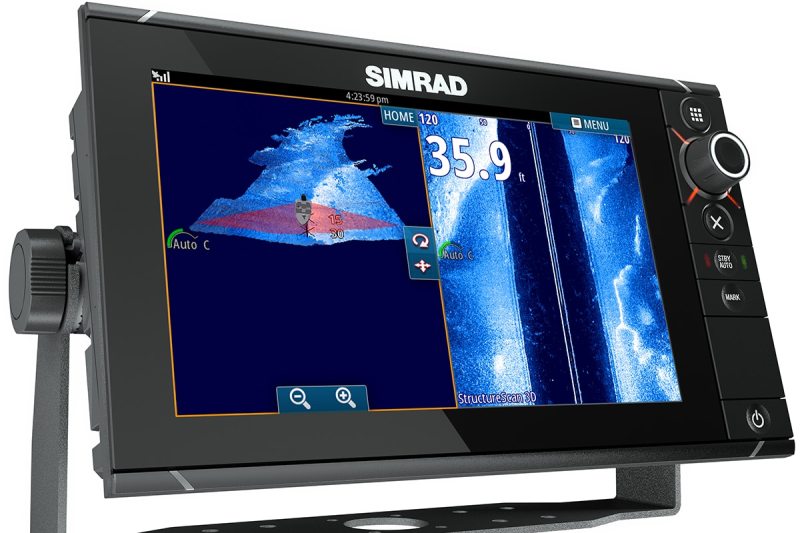
StructureScan 3D
Garmin snapped heads last spring when it released two 3-D sonars, Panoptix Forward and Panoptix Down. Each requires a compatible Garmin multifunction display (MFD), a Panoptix multibeam smart transducer and an Ethernet connection. Both Panoptix products use phased-array scanning technology that simultaneously transmits more than 100 sonar beams, which are broadcast on an undisclosed fixed frequency from discrete transducer elements. This energy returns as echoes, which the smart transducer and MFD convert into 3-D imagery.
Dave Dunn, Garmin’s senior manager of marine sales and marketing, says that Panoptix scans every surface and detail of the water column and the seafloor, rather than scanning select points and interpolating data. “We can show multiple targets at the same range,” Dunn says. “We have so much data coming in that we can use the MFD and look at the [sonar imagery] from any angle.” And thanks to the Attitude Heading Reference System sensor built into each Panoptix transducer, the system can dynamically correct its sonar transmissions to compensate for the boat’s motion, allowing the sonar to generate imagery irrespective of whether the boat is moving. Moreover, Panoptix Forward and Down sonars both have multiple display modes that graphically present the sonar data from different viewing perspectives to help increase a user’s situational awareness.
Traveling Speeds
While 3-D and forward-looking sonars increase situational awareness, it’s important to understand this equipment’s operational limits. Garmin’s Panoptix provides live 3-D imagery while a boat is motionless or moving; however, Garmin advises that users restrict themselves to “safe operating speeds.” Simrad’s StructureScan 3D requires that the boat be idling to generate imagery, with the sweet spot at roughly 2 knots, and the ForwardScan sonar has an alarm-enforced 20-knot speed limit. But given that all forward-looking sonar has a maximum range of 300 to 500 feet, a boat running at 20 knots will travel this distance in 8.88 to 14.81 seconds; at 10 knots, she’ll cover this same ground in 17.77 to 29.62 seconds. Because of this, boaters are advised to travel slowly while relying on this equipment.
Simrad unveiled its forward-looking ForwardScan sonar last winter, and its latest StructureScan 3D (SS3D) sonar complements this technology by providing 3-D imagery similar to the Panoptix Down’s “RealVü 3D Historical” mode. Navico’s approach is different from the multibeam setup. The Navico Structure- Scan 3D (SS3D) transom-hung, 455-KHz transducer has seven discrete elements: one that transmits (and receives) looking straight down, plus six side-looking elements (three to port; three to starboard).
Of these six side-looking elements, two (one to port, one to starboard) transmit energy athwartships, while the other four listen for echoes. “This allows us to receive two signals for every one that we send out,” says Matthew Laster, Navico’s product manager of sonar technology. “We know the sound wave was the same when it was transmitted, and this allows us to compare the [two] echoes, which gives us the angle difference of all returns.” This well-known principle of comparing sonar returns to derive target information is called interferometry, which Laster describes as “shooting a 3-D movie using sound instead of light.”
“We have so much data coming in that we can use the MFD and look at the [sonar imagery] from any angle.”
Hardware-wise, an SS3D system is composed of an SS3D black-box module and a SideScan 3D Skimmer transducer networked to a Navico MFD. The SS3D system creates its 3-D imagery by establishing the seafloor’s depth across the entire sonified area (the maximum operating depth is 200 feet), then scanning across this entire 180-degree sonar sweep using port- and starboard-facing elements (users can select a range up to 600 feet). This data is placed on a 3-D graphical layer. The SS3D module creates composite imagery by superimposing a 2-D graphical layer of high-resolution bottom-scanning data on top of its 3-D layer, which is sent to the MFD.
Once that image is on screen, the MFD adds a reference icon of your yacht as well as Leading Edge data, providing a graphical representation of where the beam is pointing and its most recent sonar returns, which are updated in real time. Much like a traditional fish finder’s history, imagery from the newest SS3D or Panoptix Down systems populates on one side of the display as old information “falls off” the other side. Additionally, the SS3D uses GPS data, allowing the system to correlate a given feature to its location on a chart and enabling users to create waypoint overlays of water-column targets, wrecks or seafloor structure. Unlike Garmin’s Panoptix, however, SS3D-equipped vessels must be idling to generate imagery.
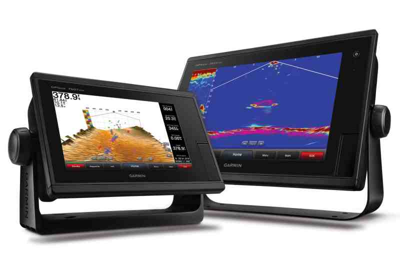
Panoptix Down RealVu 3D Historical
While the Garmin and Simrad sonars leverage different technologies, they both use contrasting colors to graphically differentiate the seafloor and bottom structure from targets in the water column. Also, both Garmin and Navico allow users to view and control their 3-D sonar imagery via a smartphone or tablet.
As for preserving coral heads, there’s no question that 3-D sonar allows you to find the best holding grounds, irrespective of any lurking apex predators.


