If you’ve ever negotiated pea-soup fog while boating, then you’re familiar with the interior of the proverbial pingpong ball. Orientation becomes confusing, and it’s easy to convince yourself that you’re heading north when your bearing is actually 180 degrees. This, of course, is the time when compasses shine.
But what if you’re cruising to the high latitudes, where your magnetic compass is no longer accurate? What if an absentminded crewmember put a toolbox full of ferrous metal in the wrong spot? Given that magnetic compasses are typically accurate to plus or minus 2 degrees, cross-track error can amount to a measurable fuel-dock bill over the course of a lengthy passage.
Fortunately, today’s satellite compasses can help, while bolstering the performance of other networked electronics.
The evolution of electronic heading sensors for the recreational-boating market began with fluxgate compasses. While reliable and capable of exporting their data as network-friendly electronic signals, fluxgate compasses sometimes struggled in heavy seas (read: gimbal lock) and had relatively sluggish reporting rates. GPS receivers can calculate course-over-ground information, provided that the boat is moving, but COG isn’t the same as heading information. Early satellite compasses followed, but they were expensive. Nine-axis, or solid-state, compasses came after that. They were affordable, fast, and generally accurate to (ballpark) 2 degrees.
Contemporary satellite compasses can provide highly accurate and reliable heading and navigational data, even when stationary. They aren’t affected by magnetic interference or declination issues, and they don’t require calibration (see sidebar). Today’s satellite compasses also are far less expensive and more accurate than earlier models.
Satellite compasses are fit inside relatively small, lightweight and weatherproof boxes that contain at least two global navigation satellite system or GPS receivers and a processor. GNSS includes several constellations, including GPS (the United States), Glonass (Russia), BeiDou (China) and Galileo (the European Union). The combination gives individual GNSS compasses ample signals to fix on, irrespective of their latitude and longitude.
Modern satellite compasses also typically include an attitude-and-heading reference system—or an inertial measurement unit that provides roll, pitch and yaw data—and allows the compass to filter vessel motion (either from heavy seas or fast rates of turn) from its data stream. Satellite compasses typically export their data—including position, COG, speed over ground and ROT, plus roll, pitch and yaw—as NMEA 2000 (and sometimes NMEA 0183) sentences.
Eric Kunz, Furuno’s senior product manager, explains that a GNSS satellite sends out signals for the satellite compass to receive. The compass “then determines the timing differences between when the signal arrives at its different antennas, even though they are very close to each other.” The timing differences are then used to determine heading.
While all satellite compasses employ the same physics, there are some design and operational considerations. For example, Garmin- and Simrad-built satellite compasses use two in-line GNSS receivers, while Furuno’s newest-generation satellite compasses—the SCX20 (NMEA 2000-friendly) and SCX21 (NMEA 0183-friendly)—each have four multi-GNSS receivers. Each Furuno compass retails for $1,395.
“Multipath interference can confuse satellite compasses,” says Kunz, referring to incoming GNSS signals bouncing off a yacht’s superstructure before reaching the receivers. “That’s why we have four antennas.” The new models each have six ways to calculate heading and rule out multipath issues, reportedly delivering heading information that can be accurate to half a degree.
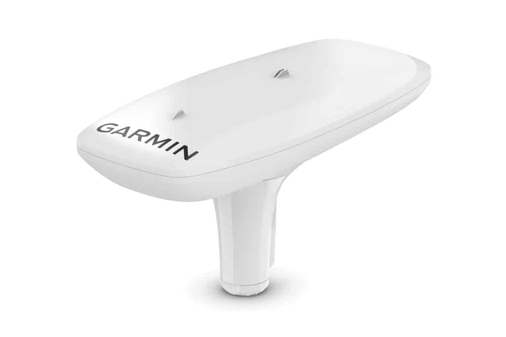
Another difference between satellite compasses is based on the frequency bands a satellite compass receives, says Ryan Schmitz, Garmin’s design engineering manager.
Furuno and Simrad compasses operate on the L1 frequency band, while Garmin’s MSC 10 compass ($1,100) employs multiband receivers that leverage the L1 and L5 bands. “Because the MSC 10 uses two frequencies, it has additional information to use in its algorithms,” Schmitz says, adding that the extra calculations yield heading information that’s accurate to 2 degrees.
Cost is another concern, and GPS-only satellite compasses sometimes offer a more affordable option. Simrad manufactures the HS60 ($1,000), which supports GPS signals, and the HS75 ($2,250), which supports GNSS signals.
“The HS60 is a fantastic option for the smaller-powerboat owners who are using autopilot and/or radar,” says Mat Hooper, Simrad’s product director. “The HS75 suits the needs of larger vessels, where longer-range navigation requires as-accurate-as-possible information.” According to Simrad, the HS60 and HS75 deliver heading information that’s accurate to 2 degrees and 0.75 degrees, respectively.
Technical details aside, satellite compasses deliver significant upsides. Satellite-compass-equipped boats “use less fuel on point-to-point trips, either hand-steering or on autopilot, because they have a heading system with almost no error,” Kunz says.
Hooper agrees, adding that a heading sensor is critical to having all features available on networked systems. “It’s used to orient a chart on your multifunction display, provide steering data for an autopilot and enable advanced radar features like Doppler processing,” he says.
Schmitz also points to advanced radar features—including radar overlay atop cartography as well as target tracking—as examples where accurate heading-sensor information is critical.
Another key benefit is that satellite compasses use GNSS/GPS signals—not the Earth’s magnetic field—to derive their heading information. “With today’s vessels being fitted with more and more electrical equipment, finding a magnetically clean area to fit a traditional magnetic compass is increasingly difficult,” Hooper says.
The drawback list for satellite compasses is sparse. There’s expense, but prices have dropped precipitously. And for anyone planning longer passages, these costs can be amortized via fuel savings over time.
So, if you’re interested in bolstering your helm’s precision, consider upgrading to a satellite compass. You’ll be darn glad you did the next time a landlubber unwittingly parks a toolbox next to your ship’s compass.

