Deep Color
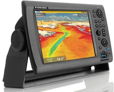
NavNet 3D from Furuno has improved its 3-D functionality, offering boaters a 360-degree underwater perspective drawn using both worldwide bathymetric data and high-resolution detail for U.S. coastal waters. The data is preloaded in any NavNet 3D multifunction display (starting with the 8.4- inch model at $3,595). NavNet 3D also shows satellite photos in 3-D perspective mode with images for the entire U.S. available for free download at mapmedia.com. Furuno, 360- 834-9300; furunousa.com
Point of View
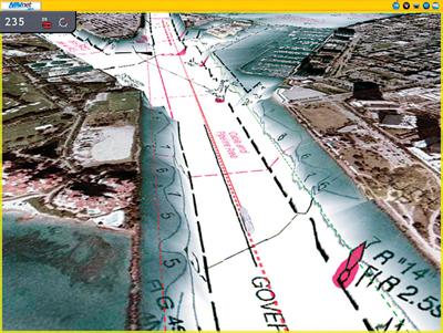
EarthNC offers its online chart viewer for free to anyone with a personal computer. The viewer depicts a fusion of charts from EarthNC, Google and NOAA and can show surroundings in 3-D, complete with navaids, weather data and tide predictions. Users can draw a custom route and save it to various formats. There’s a 2-D version for iPhone ($25), and an Android version is available ($10). EarthNC bundles its software and charts for PC or Mac with a USB GPS to convert any laptop into a 3-D chart plotter ($150). EarthNC, 866-691- 3836; earthnc.com
**
**
Time Warp
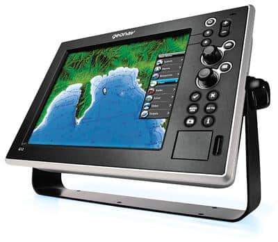
Italy-based Geonav is storming the U.S. market with its G12 multifunction display ($4,299) at the Fort Lauderdale Boat Show. The G12 is the first MFD to display C-Map 4D cartography as well as charts from Navionics and comes preloaded with reference charts from both companies, with detailed charts available from their respective catalogs. The fourth dimension implied in the name is time: Download revisions of the cartography any time, not just at prescribed intervals, because the database is updated continually. C-Map 4D includes “true-view” and “photo” features, providing high-resolution coastal satellite imagery and interest-point photos. Geonav Marine, 877-455-6660; geonavmarine.com; C-Map by Jeppesen Charts, 800-424-2627; c-map.com