WagonWheels
In Maine, men once upon a time carved huge blocks of granite from the islands, using mostly muscle, and they called the grain structure they worked “the Run, the Rift, and the Hard Way.” The evocative phrase also serves to describe cruising this coast’s thousands of isles today. It’s relatively easy to run Down East from Portland to Cutler enjoying nearly innumerable secure harbors, both inhabited and wild. Instead of a continuous coastline you’ll find one rifted by tall Bays, like Penobscot and Blue Hill, that let you meander into the state’s more pastoral interior; picture gentle shores overhung by birch and oak trees rather than the stereotypical salt-stunted spruce. And you’ll delight in the long veins of gray-and-pink granite where molten magma once bubbled up through rifts in the planet’s skin and then was smoothed by millennia of sea action to form sculpture you can walk on. But what’s hard is visiting the outermost islands that arguably host the most intense flavor of Maine’s natural beauty.
Consider Wooden Ball, a mere 23 miles down Penobscot Bay from my lovely though highly civilized homeport of Camden. It’s a mile long but lacks anything you could honestly term a boat harbor. Heck, it doesn’t even have vegetation big enough to call a tree but, wow, is it alive in the summer! While it’s been well over a decade since my only visit, I have vivid memories of how the wee hollows in its endlessly varied ledges host cranberry bogs scattered with wildflowers and cattails, all happily overseen by songbirds. Of course there are many sea birds too, including rare species like roseate terns that are why many of these outer islands are off limits until the nesting season ends in mid-August, which makes it even harder to catch the right weather window.
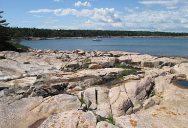
I also remember how tough it was to get ashore in our tender, first to find a remotely reasonable spot and then to get over the jumble of wave rounded rocks, some granite in pinks and grays from the nearby rifts, that wanted to do some more tumbling underfoot. (Note that when these rocks grind down to sizes under about a half-inch and gather in a less exposed spot, Mainers tend to call it a beach.) Then were the minke whales working the herring that in turn worked whatever upwelled as strong tidal currents scoured the shores.
Had I paid more attention to those currents I might have avoided the embarrassing fact of the day. While my mate and I wandering the island in a Thoreauvian daze, my boat at the time, a fast 25-footer, dragged her anchor toward very deep water and if it weren’t for the extraordinary luck that a couple of good samaritan urchin divers were enjoying the same calm day in the same spot, we might still be on Wooden Ball Island.
But my taste for Maine outer islands was only whetted by that experience, though now I’m even more careful about how I go about visiting them. I’m very keen, for instance, on the various new tools that can warn me if my boat is dragging anchor even when I’m, say, a mile away picking cranberries.
One such tool is a clever smartphone app called Boat Monitor. Sensing anchor drag is not simply a matter of marking a spot with GPS, picking a safe radius and getting an alarm if your boat exceeds the radius, even if that’s all some anchor watch functions on chart plotters can do. The actual spot you want to mark is where the anchor is and you can do that with Boat Monitor either by having the phone at the bow when setting the hook or, better yet, entering your bearing and distance from the anchor once you’ve settled into position. Plus you may well want to know if your boat swings significantly around the anchor, even if it hasn’t yet exceeded the same radius from it, and Boat Monitor lets you do that by defining an additional pie-shape alarm area.
These anchor drag alarm nuances could be programmed into a chart plotter, but what Boat Monitor and similar apps can do naturally, and that no marine display is capable of yet, is to send a text message to another phone that’s in your pocket while you’re exploring ashore (or dining out). Heck, if you have an iPhone, Boat Monitor can even verbalize the alarm with distance and bearing.
But for this scenario to work you do need to leave a smartphone on the boat and have at least a texting phone with you, and there are some interesting alternatives. One is the Garmin GTU 10, a tiny wireless and waterproof GPS with a low-cost cellular data service built in. It’s designed for tracking dogs, children, dinghies, etc. but I found that it works pretty well as an anchor dragging alarm too. That’s because the system allows you to use a PC browser or a Garmin phone app to create detailed geofences and then tell the GTU 10 to notify you if it leaves (or enters) the “fenced” area. It would be nice if Garmin added marine charts to its Tracker applications, but the GTU 10’s current location is shown on regular maps, and I’ve usually been able to draw a safe anchoring area with that and a shoreline.
Meanwhile, the Siren Marine Sprite cellular monitoring system I’ve been testing does not support complex geofences but it will remote alarm you for a small position change and deserves consideration because it can mind your boat in so many other ways. For instance, a Sprite can be set up to send you regular reports on battery voltage and refrigerator temperature and/or alarms on unauthorized entry, and it can disable an outboard from half way around the world. And it can do all this via simple text messages or a more verbose app.
So when I hike remote Maine islands with poor anchorages these days, I usually have a way to alleviate my dragging anxieties. While I need to include the “usually” qualifier because some of these islands lack cellular coverage, there are, or will be, ways around that too. Garmin, for instance, has a high-performance cellular modem called the GDL 40 that’s currently used to deliver weather info to its displays but could, I think, become part of a very able off-boat tracking and monitoring system. There are also low-cost satellite alternatives like the Spot Hug, and I understand that we’ll eventually see Iridium “small burst data modems” built into multifunction displays so your boat electronics can text you!
That same Iridium modem is already inside the wonderful DeLorme inReach tracking and messaging handheld that I’m now glad to take ashore in wilderness spots like Wooden Ball Island. If I did somehow lose my boat ride home, the inReach could not only notify the search and rescue services with my ID and exact location but also let me text with them about what might happen next, all without regard to cellular coverage.
I’ve also become fond of Simrad’s StructureScan as a tool for analyzing the bottom before I drop anchor. StructureScan is used primarily by fishermen looking for productive underwater structures like ledges and wrecks, and it does not see ahead of a boat. (While that would be ideal for a gunkholer like me, forward-looking sonar doesn’t have the resolution I’d like yet). But StructureScan is a relatively inexpensive add-on that sees sideways in great detail, and a spin or two around a potential anchorage tells me a lot about what’s there. Humminbird also manufacturers inexpensive side-imaging sonar and Garmin recently purchased Interphase, a leader in forward- looking sonar, which bodes well.
But won’t the cruising guides tell me about island anchorages, you might ask? There are several good resources, including the excellent print publication A Cruising Guide to the Maine Coast and the international cruise info-sharing site ActiveCaptain (which was founded by Mainers). However, “Catch-22” style, the outer islands, especially the most exotic and difficult ones, are not well covered because they’re not often visited.
Fortunately, though, the Maine outer islands are a focus of wildlife preservation organizations, which, in turn, are often fonts of information for boaters with a hankering for exploration. Visit the U.S. Fish & Wildlife Service’s Maine Coastal Islands National Wildlife Refuges site, for instance, to learn about the 50 islands they oversee. The Maine Coast Heritage Trust and local trusts like Boothbay Region also manage uninhabited islands for wildlife and human visitors, and don’t miss the Maine Island Trial Association. MITA may be oriented mainly to kayakers but its online and printed guide is fabulous asset for any cruiser.
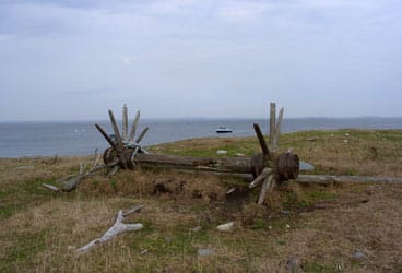
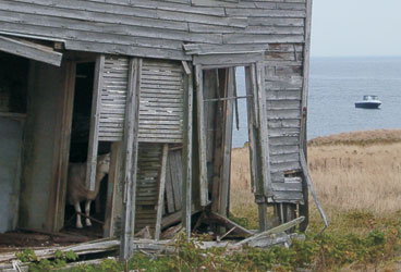
Strangely enough I still don’t know what individual or organization owns Wooden Ball Island. There was no signage, at least when I visited, and the only sign of people was a long-abandoned shack that seemed to have once housed bird watchers. But I have learned, somewhat to my chagrin as an “adventurer,” that there was a time when heartier folks farmed Wooden Ball and similarly raw island jewels all along the coast of Maine. That was the Hard Way, indeed.
To read more articles by Ben Ellison, check out his Marine Electronics Blog.
To read more about Maine, try Christopher White’s article Where to Stay: Maine Marinas and Resorts
or Mary South’s article Cruising Mid-Coast Maine.


