Once upon a time, yachtsmen could be picked out on commuter trains and sidewalks not only for their natty attire but for the large-format paper charts rolled and held under their arm. The scent of adventure wafted behind them as they made their way out of the city on summer afternoons, perhaps not to be seen again for weeks as they cruised over the horizon. Times have changed. While paper charts are still a necessary addition to every responsible boater’s pilothouse, the electronic versions of the cartography get much more use these days. And the way users get and update that information is changing rapidly.
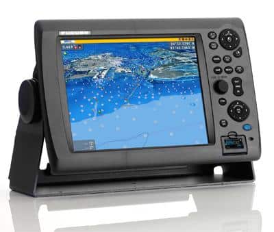
Boaters who upgraded to Furuno’s NavNet 3D system (www.furunousa.com) may have been surprised to learn the charts for all coastal U.S. waters and the Caribbean were already preloaded onto their units. C-MAP by Jeppesen MapMedia charts (www.jeppesen.com) boasting accurate cartography and loads of detail are already loaded on each unit. The charts allow 2D or 3D presentation using NavNet 3D’s seamless TimeZero interface for a home-computer-like navigation experience. Users simply choose their preferred chart region from among eight wide chart regions preloaded onto the plotter. They go for $300 each and cover large cruising areas.
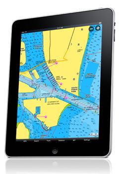
Navionics Mobile v4.0 (www.navionics.com) is a charting program that works on app-enabled mobile devices—including the iPhone, iPad, iPod Touch, and Android smartphones. While they’re not necessarily quite ready for full-on navigation, they’re definitely interesting from the perspective of the immense amounts of available data, where it lives, and how simple it is to keep up to date. They are powerful backup devices as they stand now—they can record tracks and routes, access the Navionics database of points of interest—an immense resource for the marina resources alone, and check tides and currents. As these devices get more powerful, we would not be surprised to see route planning and other functions automatically uploaded to the helm array as the user steps aboard in cloud-computing fashion. Stay tuned.