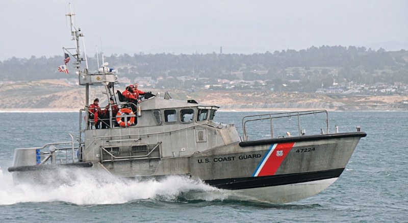
USCG SAR
Think about your helm’s electronics suite and what it provides, and you’ll get some insight into what makes you feel secure on board your boat. Chart plotters allow detailed route planning, so your time of arrival at your destination can be estimated to the minute. Satellite weather lets you find a safe window for your next leg. And if it doesn’t look good, you’re not going. As recreational boat systems have evolved, they’ve gotten better and better suited for the tasks at hand.
That’s in direct opposition to the way U.S. Coast Guard personnel serving on search-and-rescue boat crews need to use their electronics. When they leave the dock on a search and rescue call, they don’t always know exactly where they’re going. And chances are, if they’re getting the call, the weather is getting a bit sporty. Guess what? They’re going anyway.
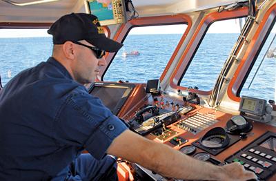
But the capabilities of your electronics and that of the Coast Guard crews are the same. “It’s all pretty much fairly straight off the shelf — we have a Furuno 1933c with a 10-inch screen,” says Chief Warrant Officer Luis Munoz, who commands Coast Guard Station Gloucester on Cape Ann in Massachusetts and oversees search and rescue (SAR) operations with three boat crews. “If you bought a really nice boat, it’s what you’d have. We’re able to use all these features to help us in search and rescue: We’re able to plot positions quickly and do radar overlay to locate targets.” Getting crew and boat home safely is a top priority, and these systems help. But the Coast Guard’s mission is to come home safely with the crews of other boats as well.
As with all emergencies, it all starts with a call for help. The Coast Guard answers that call — usually over the VHF radio — and the watchstander tries to ascertain the position and nature of the emergency, but the responders also use the signal the call rode in on to locate the caller — it’s called Rescue 21. “Rescue 21 is an upgrade to our radio-communication system,” says Lieutenant Garrett Meyer of Sector Boston. “Basically it allows us to monitor marine-radio traffic along the coastline from the sector command center through the use of a series of overlapping antennas called RFFs [Remote Fixed Facilities]. The system provides a Line of Bearing, what we refer to as an LOB, from the RFF to the source of the radio call. In many cases, we pick up two or more LOBs [from multiple antennas receiving a single call] that intersect, giving us an approximate position of the radio distress call.”
The system gives the SAR crew a starting point for their search. This is important, because even experienced, skilled mariners can get flustered when things go wrong. “It reminds me of a case I had in St. Petersburg, Florida,” Meyer says. “In December 2006, a Mayday came in over the radio: The individual passed us a GPS position, he was the only person on board, and his vessel was taking on water and then we lost communications. Since we were able to collect the critical information before losing communications, the case seemed to be pretty straightforward.” When the crew arrived on scene they found no person in the water, no boat or debris. There should be some indication they’re in the right spot.
“So we looked back in our Rescue 21 and found that we had two intersecting lines of bearing which put the position of distress approximately three or four miles from the position that he’d passed,” Meyer says. “We updated our emergency broadcast, and a Good Samaritan in the area proceeded to that position and pulled him out of the water. In the stress of the situation, the mariner had read a previous waypoint from his GPS and not his current position. It’s an easy mistake to make in a stressful situation and it would have been impossible to identify using the old system. In my opinion, Rescue 21 was vital in locating the distress location and saving this individual’s life.” Direction-finding equipment works off more than just radio signals, and the signal from an EPIRB is detected by Coast Guard assets as well as the satellite system.
“Some of the other investments we’ve been making in electronics on Coast Guard aircraft is the ability to use the 406 MHz signal of an EPIRB for homing, which is a much stronger signal than the 121.5 MHz direction finding signal every EPIRB also transmits,” says Commander Max Moser, chief of the policy for search and rescue. “If someone in the United States maritime search and rescue region turns on their EPIRB, the satellite will receive the 406 MHz distress signal and the system will compute an approximate position. The Coast Guard will be notified of the distress, launch an aircraft to investigate and the aircraft equipped with 406 MHz direction finding technology will home in on the primary 406 MHz signal and locate the person in distress. We’ve had cases where Coast Guard aircraft have been able to receive the 406 MHz signal from over 100 miles from the distress location. By comparison, the EPIRB’s lower wattage 121.5 MHz homing signal can only be received by Coast Guard aircraft within about five miles of the distress location. We’ve had great success with homing in on the EPIRB’s 406 MHz distress signal.” The Coast Guard dropped the requirement for 121.5 MHz signals on these devices a few years ago, and now use just the 406 MHz signal.
SAR operations are not always as neat and tidy as sending a boat out to follow a radio signal or home in on a beacon. Power systems on stranded vessels fail. Health problems in the overdue crew crop up. Weather deteriorates. Time is of the essence. “One of the biggest electronic assets that we use is the ability to share search plans, search areas and that type of information from sector to sector,” says Moser. “If a sector is providing the case information to the district office, they’re able to forward all the work they’ve done through the Internet. The information is used in our search planning program, SAROPS, the Search And Rescue Optimal Planning System, a landbased system that benefits from our ability to transfer search information back and forth between units. Along with Rescue 21, it allows them to capture that information and provide it to whomever may need it in different types of files.”
“We’ve had cases where Coast Guard aircraft have been able to receive the 406 MHz signal from over 100 miles from the distress location.”
As the search progresses and more Coast Guard units are deployed, SAROPS makes sure that they all have the pertinent data. “We add a number of inputs: for example, we identify the most likely search object and the time and location that it would have started to drift,” Meyer says “We then apply wind and water current information to the scenario and the time a search asset will be on scene. The program then simulates the drift of the search object. Next, we add specific information about the search asset, or multiple assets, and the program will develop search patterns that keep our assets in the areas where the distressed mariner is most likely to be located. Depending on the rate of drift, we will not just search where the call came from, but where it is predicted to be when we arrive on scene.”
The search plan is built on understanding the direction of travel for an object that is unable to control its movement on the surface of the sea. So comprehending the effects of weather conditions are key. “For meteorological information, wind, drift, seas, conditions out there — everything that affects where an object is going to go when it enters the water or what the conditions are out there so we can provide better searches — we use what’s called a self-locating datum marker buoy, or SLDMB,” Moser says. “It basically looks like an inverted umbrella, and, when dropped overboard from a vessel or aircraft, activates automatically and sends a signal to provide GPS information on where it is. They provide water currents and sea temperature. We also have an Environmental Data System (EDS) that collects data from a variety of sources and provides wind and currents input data to our SAROPS program, pertinent information that helps the people who are conducting the search planning.” The buoys can be recovered but are also biodegradable if lost.
As technology advances, searchers are more efficient and spend less time in adverse conditions. Pay attention to what your electronics tell you, and hopefully you need not rely on those of the Coast Guard.