ytgfeb09elect1.jpg
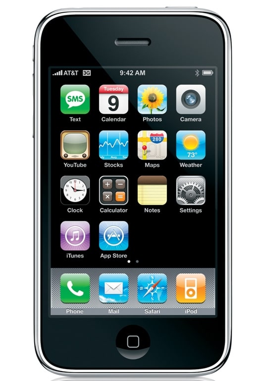
The Apple iPhone 3G is the electronic equivalent of a really handy Swiss Army knife-it can get you out of a jam. But unlike the knife, which will always have the same tools as the day you bought it, the iPhone can be updated with all manner of useful items whenever you wish. Because it is a small, malleable computer, the iPhone can add these new tools-Apple calls them “apps,” short for applications-as they become available on the App Store, the online distribution channel accessible by computer or iPhone.
But I already have a cell phone, you may be thinking. Consider then, that the iPhone operates in two primary modes: as a very smart mobile phone when in range of a GSM cellular network; and as a stand-alone computer, making it usable even in the middle of the ocean. When you look at what the iPhone can do by itself, it’s clear that it is really first a computer, with the added ability to function as a cell phone.
You probably already have a computer, too-in fact you probably have more than one aboard, if you give it some thought. So why bring another along? Bear with me and get a glimpse into the future.
More Than Calls Say you do get an iPhone. Here’s how to take the plunge: First, download the iNavX app ($49.95) from the Appstore. Touch the on-screen iNavX icon and the application will open, determine your position using information from the integral GPS receiver (or by triangulating from cell-tower and wireless-network positions, if GPS signals are not available), and automatically download the United States raster navigation chart appropriate for your current position.
If you are in range of a WiFi hot spot-which you may be at your slip-a typical chart download will take about 30 seconds, or a few seconds more when using the 3G network. Zooming and scrolling the chart is done with your fingertips on the touchscreen-the phone has no tiny stylus to lose, and no little keys to mash. Although the iPhone’s screen is by no means large at 3.5 inches diagonal, it is capable of displaying fine detail (480 x 320 pixels) and is easy to read in most lighting conditions, including when wearing polarizing sunglasses.
Five icons along the bottom of the screen control the primary functions: Chart, Info, Waypoints, Instruments, and Tides. The integral tide app is available at a small additional cost, although there are a number of free tide and current apps available that are accessed using their own icons. A setup command at the top of the screen accesses the seven on-screen toggle “switches” that control plotter performance.
Once the charts for the navigation area have been downloaded, the iNavX program operates independently of the cellular network. The memory capacity of the iPhone-either 8 or 16 GB, depending on the model- makes it practical to download and store all the charts you are likely to need for any voyage in U.S. waters. Charts for foreign waters must be purchased since, unlike the U.S., other countries copyright their charts and charge for each one.
The iPhone’s iNavX chart plotter functions are similar to your fixed-mount chart plotter, allowing you to enter, import, and export waypoints, measure bearings and distances and view your course, speed, and lat/lon position. It can automatically create a 100-point chart track that can be very useful when used in the tender to collect soundings in a channel through an uncharted area. The iPhone’s WiFi link is used to transfer data to and from your on-board computer via the iNavX program’s TCP/IP NMEA client feature. This allows you to display data from the yacht’s instrument system on the phone, including AIS targets, when that data is available. Think about that for a moment. You now have access to your nav data in your pocket-including AIS targets-from anywhere on board.
Fun FunctionsMany cell phones have built-in cameras. Pictures you take with the iPhone’s 2 megapixel camera and “screen shots” like that on the first page of this article can be emailed to friends and easily downloaded to a Mac or PC laptop on the boat, creating a useful navigation record.
When in range of a 3G cellular network or a WiFi hot spot, the phone’s Safari web browser can be used to access the National Weather Service (NWS) website (www.nws.noaa.gov) to view real-time images from the NWS Doppler radar and access all of the other marine-related NWS information. The AeroWeather app provides virtually instant access to up-to-the-moment weather observations and forecasts for nearly any U.S. airport, useful since airports are an excellent source of weather information for many popular boating areas. You can also access the Physical Oceanographic Real Time System (PORTS) system (tidesandcurrents.noaa.gov/ports.html) to obtain real-time tide, current, and wind information at numerous reporting points in many of the nation’s ports.
Approaching a port you have not previously visited? Use the GoogleEarth app to access the latest satellite image of the area. Need to arrange land transport? The Maps app will display the road network and can be used to obtain driving, public transportation, and walking directions to a destination. Want to find a nearby restaurant? The Urbanspoon app will simplify your search.
Your iPhone can be used to fix your position in a historically accurate and somewhat quirky way, as well, should your GPS receiver fail. Though that’s not very likely, it makes for an interesting scenario to test yourself. The “Clinometer” app provides a multi-function position sensing and measurement tool that operates as a two-axis bubble level when the phone is horizontal and as a direct reading inclinometer when held on a vertical plane. With the Clinometer set to read in tenths of a degree, you can use the long edge of the phone to sight the sun, a planet, or a star. With the chosen celestial body in view a touch on the “lock button” on the Clinometer screen will capture the body’s elevation. Note the time on the iPhone screen. Then, extract the necessary data from your Nautical Almanac, and you are ready to use the iPhone’s built-in scientific calculator(touch the calculator icon and then turn the iPhone sideways to reveal these functions) to reduce the sight and obtain a line of position.
The sight-reduction process will be simplified by the fact that there is no need to correct for height of eye (or for dip short of the horizon when practicing celestial navigation in constricted areas) since the angle measurement is referenced to the phone’s very accurate internal sensor system. Of course, as a prudent navigator, you always carry a copy of the nautical almanac on board or download a couple of week’s worth of data before leaving port. While the precision of the measurement of the elevation of the celestial body may not match what a practiced navigator can obtain using a proper sextant, this “iPhone sextant” can be used when there is no visible horizon and will likely produce at least as accurate a fix as one could get with a bubble sextant.
There are also a number of more mundane uses for the Clinometer application: We used it to measure accurately the angle of heel of our sailboat when we were testing the ability of a satellite-television system’s antenna to remain locked onto the satellite in “lively” sea conditions, and also used it to level a picture frame on a bulkhead, after measuring the angle at which the boat was floating.
The way the iPhone links everything together-on-board systems, web-based charts and information, your own eyes-is the wave of the future of electronics. Mull that over, secure in your slip as you peruse the free Drinks app. This program provides recipes for more than 5,800 drinks and cocktails, including that Caribbean favorite, the “Painkiller” made with that most traditional yachting drink, Pusser’s Rum.