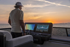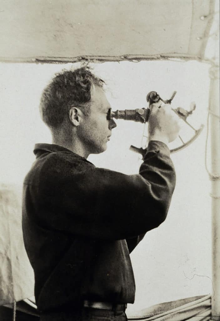
New york city’s East River may be only 16 miles long, but this didn’t quell Giuseppe Carnevali’s pre-cruise jitters on a historic 1984 day. Carnevali, the founder of Navionics and one of the industry’s longest-standing CEOs, was testing his Geonav — the first electronic-chart display for the recreational marine market — and his audience included the press. Carnevali had put a tarp over the helm and windows to eliminate visibility, sured onlookers the radar was depowered, lest it provide any navigational clues and ruin his shot at plying the Big Apple’s harried waters, sans a horizon. “I had used [the system] before, but in nonchallenging conditions,” Carnevali recalled. “[The sea trial] went perfectly, but it was a revelation: Now, I do something 10 times before I invite the press!”
While not all milestones in the history of recreational marine electronics unfurled under so much pressure, the past 70 years have seen bilge-shaking innovations that have shaped how modern mariners enjoy on-the-water pursuits.
THE AUTOHELM
Spend enough time cruising, and the joy of hand-steering fades, especially during the graveyard watch. Elmer Sperry (1860-1930) is the inventor of the first working gyrocompass system (1908) and, vis-à-vis, the gyrostabilizer (1913). He is credited with the 1920s invention of the Metal Mike, the first gyroscope-guided autopilot system. It was designed to steer heavy metal, including U.S. Navy warships, instead of private yachts. In fact, the recreational boating market had to wait almost 50 years until the British-born inventor Derek Fawcett (see “Altruistic Innovations”) started tinkering in his garage workshop to get this tech.
Fawcett, a longtime and passionate sailor, understood the utility of an autopilot, and in 1974 he founded the family-run Nautech and unveiled his first Autohelm, a trade name that quickly became synonymous for all autopilots (think Ziploc bags). Fawcett’s first Autohelms were cockpit-mounted, stand-alone systems that used 12 volts of DC power, via the house battery, and a hydraulic arm to tame a sailboat’s tiller. The early Autohelm relied on an external wind vane for apparent-wind-angle information, rather than a gyrocompass or any electronic position information; sailors would simply set a course based on their desired angle of attack, and the Autohelm would drive to the desired apparent-wind angle.
Not surprisingly, Fawcett’s brainchild made a huge market impact. Nautech quickly began selling lots of Autohelms and, in 1976, Fawcett was awarded the prestigious British Design Award. More innovations and improvements followed, including the addition of an integral gyrocompass, which allowed navigators to set course based on their desired wind angle or their preferred compass heading. In 1984 came a user-friendly, push-button keypad that offered simple controls such as “Auto,” “Standby” and “+1°/-1°” and “+10°/-10°” — a user interface that remains essentially untouched today. The Autohelm legend grew.
In 1989, Fawcett earned a second British Design Award as well as a Silk Cut Nautical Award for the SeaTalk network, a digital-communications protocol that allowed Autohelm units to “talk” with other onboard instrumentation via a single-cable connection (a predecessor to contemporary NMEA 0183 or NMEA 2000 protocols). Fiona Pankhurst, Raymarine’s head of corporate marketing and public relations, said Raytheon purchased Nautech in 1990 so the American-based firm could access Nautech’s extensive European distribution and sell its radars on the continent. In 2001, Raytheon’s Recreational Marine Division was spun off (via a management buyout) into Raymarine, which continues to employ some of Fawcett’s forward-thinking concepts, including the third-generation SeaTalk NG.
RADAR
It’s ironic that radar’s history is somewhat foggy, but this can be attributed to the 51 years it took to develop the technology from premise to prototype, the first of which was fitted to USS Leary in 1937. Heinrich Hertz, a German physicist, demonstrated in 1886 that radio waves reflect off solid objects, and by 1897 Alexander Popov, a Russian physicist, hypothesized that radio waves could be used to detect objects, but it wasn’t until 1904 that Christian Hülsmeyer, a German inventor, proved that radio waves could detect a fogbound ship. In 1922, two U.S. Navy researchers realized a ship passing through radio waves caused a signal disruption, but the U.S. government didn’t develop the technology until the eve of World War II, in conjunction with the British government.
While British scientists developed motor-turned radars (replacing manually turned units) and, critically, the top-secret cavity magnetron — a microwave-generating vacuum tube that boasted 100 times the power of previous tubes — Raytheon was selected to develop and manufacture the magnetron. In 1941, Raytheon was contracted to build 100 radar units for the U.S. Navy, and by 1944 most American-flagged warships were radar-equipped.
On Feb. 14, 1946, the Kalakala, a Seattle-based ferry, became the first civilian-operated vessel to use commercial radar (a Raytheon prototype). “It’s very good, and we hope eventually to have them on all the ferries,” E.W. Peabody of Black Ball Ferry Lines told The Seattle Times. “Right now, though, we can’t get them. What the instrument really is, is a Navy model with commercial modifications.”
Availability improved: In 1948, U.K.-based Kelvin and Hughes acquired type approval for its marine radar; Decca Radar released its Model 159 in 1949 and, in 1952, JRC built Japan’s first 9,000 MHz-band radar unit. The 1950s saw the advancement of “transceiver-up” technology, allowing manufacturers to bundle the transceiver into the antenna, eliminating bulk and complication. This led Decca Radar to develop its Model 101 — advertised for small boats — and enabled Furuno to begin selling radars to commercial vessels in 1959. British firm SeaScan soon developed radars for boats as small as 30 feet, but the next major breakthrough came in the late ’60s when transistor-based radars arrived. Improved range and imagery, as well as miniaturization (critical for yachts) all followed, and in 1986, Furuno introduced radars that could spot birds.
GEONAV
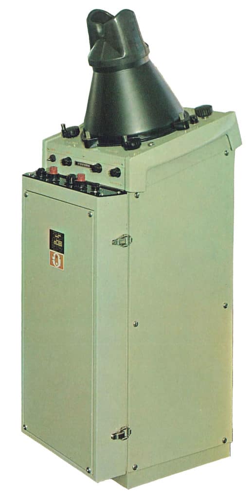
1980s recession — a time when Carnevali, a naval architect and a father, found himself unemployed. As he was considering his options, he saw the James Bond film Goldfinger and was inspired by 007’s in-dash navigation system aboard his Aston Martin. “I turned science fiction into reality,” Carnevali said. While the team’s prototype attracted attention from established companies, ultimately all takers vaporized and Navionics found itself building electronic chart displays (ECDs) — the forebear of today’s multifunction displays — and the necessary digital cartography.
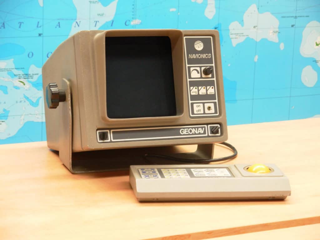
“It could plot a course, but the cartography was rudimentary — only coastlines and some basic contours,” Carnevali said of “the microwave,” Navionics’ in-house name for its prototype, which was the size of a large version of its namesake. “It could zoom in and out very fast using very little memory — we’re talking kilobits or kilobytes — as saving memory was important back then.” The first Geonav used a 12-inch CRT display and was housed in a large case to accommodate its power-supply needs; early-generation commercial units used smaller, cast-aluminum bodies, but they were still cumbersome and used external receivers. Given that GPS didn’t exist, Geonavs relied on loran in North America and Decca in Europe for position information.
Building accurate digital charts was the other major hurdle. “We started on the right foot with vector and seamless cartography,” said Carnevali, who explained that the first e-charts came on cartridges the size of cigarette packs. “We also developed a digital format that’s still used today.” Carnevali said Navionics digitized its first geographical feature — an island — by contracting a company that had an early digitizing table. “It came on 8-inch floppy disks, but we only had knock-off Apple [computers] with 5-inch disks, so we couldn’t transfer the data.” The solution was to print the chart and manually enter the information on its imitation machines. “When we finally put it on a monitor, it was rotated 90 degrees, but we invented software that inverted it!” Carnevali said with a laugh.
Marketing the Geonav proved challenging, exacerbated by the notoriously tight-purse and conservative-minded sailors he was catering to, but resistance slowly eased. Still, some serious-minded pioneers — including the Prince of Monaco and the fabled TV-anchorman-cum-sailor Walter Cronkite — adopted the technology, and word spread. Navionics exited the hardware game in late 2007, but it continues to explore new boundaries with its contemporary cartography.