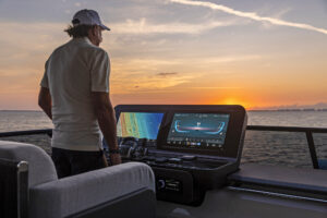
It’s not every day that you see a ship hovering above the sea. Of course, it’s also not every day that you find yourself sailing from Ketchikan, Alaska, to Seattle under warm and sunny solstice skies—but there I was. And there was the gravity-defying ship.
Just as I began to question my watch-standing skills, Erden, my friend and shipmate, explained that fata morgana is an atmospherically triggered optical illusion that can make distant objects appear to hover. We checked the AIS, and our mirage was an actual ship plying actual brine.
Given that we had hundreds of miles to go, there was time aplenty to ponder whether AIS could also experience situational-awareness hiccups. The answer is yes, and the solution is already being developed. The VHF Data Exchange System (VDES), once operational, should make boating a better, safer and even more information-rich experience than it is today.
To understand why, we need to start with AIS. On March 24, 1989, the Exxon Valdez found the bricks in Alaska’s Prince Williams Sound, triggering one of history’s worst environmental disasters. A year later, as part of the Oil Pollution Act, lawmakers tasked the U.S Coast Guard with creating a vessel-tracking system (VTS) for tankers operating in the U.S Coast Guard Vessel Traffic Service in Alaska. The resulting system was based on VHF radio communications, as well as shore-based monitoring and polling systems.
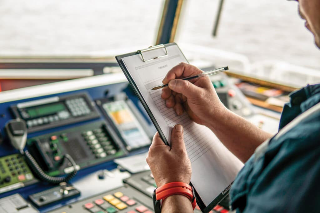
This system evolved into what became global AIS. By 2000, the International Maritime Organization began mandating that most sea-bound ships carry Class A AIS transmitters for collision-avoidance purposes and as a VTS tool. These transmitters broadcast information—including the vessel’s name, position, course, speed, navigational status and unique MMSI number—on dedicated VHF channels 87B and 88B every two to 10 seconds, depending on vessel speed, while also listening for incoming AIS transmissions.
In 2006, the AIS standards committee released specifications for a Class B-CS AIS system, which is a “polite” system that’s interoperable with Class A AIS on a non-interference basis, for voluntary users. The Class B-CS employs the same two VHF channels, but it broadcasts every 30 seconds.
In 2013, Class B-SO transmitters arrived. These operate on the same self-organizing bandwidth scheme as Class A systems; however, they transmit every five to 30 seconds.
Overall, while there are many differences between Class A and Class B AIS transmitters, all AIS transmissions operate on just the two VHF channels: 87B and 88B. Given the amount of critical data that flows across these channels on crowded waters, bandwidth emerges as AIS’ limiting factor.
Enter VDES. The VHF Data Exchange System bundles existing technologies into one communications hub.
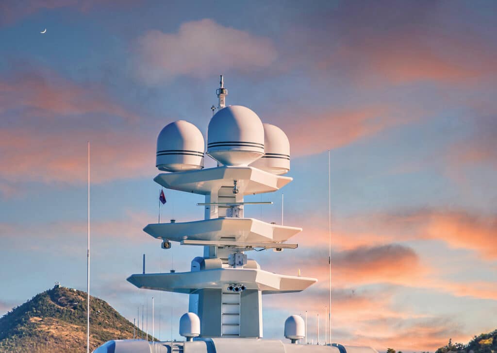
VDES is composed of four key components: AIS, VDE Satellite, VDE Terrestrial and ASM channels. Much like modern smartphones that seamlessly tackle roaming and multiple frequencies, an onboard VDES box (once the system is operational, circa 2025 to 2035) should be able to listen to 12 different frequencies. These include two frequencies for satellite-based long-range AIS, two frequencies for sending and receiving AIS-based messages, six channels for receiving terrestrial or satellite-based data, and six channels for transmitting satellite data.
“The goal with VDES is to move non-ship-to-ship traffic off AIS so that AIS is primarily for collision avoidance, and for other marine-safety information to migrate to the other VDES channels,” says Jorge Arroyo, a U.S Coast Guard program-and-management analyst. While all AIS devices will continue to work, unchanged, the overall system will be more efficient, robust and broader. “What I’m talking about today will hopefully be seamless in the future,” he adds.
While the ability to send updated navigational chart corrections or certain marine safety notifications via VDES offers a glimpse at the future, Arroyo envisions bigger dividends. “Real-time weather could be the killer app,” he says, adding that he hopes ships will share real-time weather information with other VDES users on the high seas via mesh networks that also share the information with satellites.
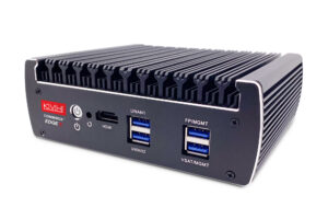
Dave Dunn, Garmin’s senior director of marine sales, says, “VDES is in the stratosphere, but it will trickle down.” And there’s less freeboard to this drop than one might think. In 2019, Vesper Marine, a New Zealand-based AIS company, unveiled its Cortex communications hub, which bundles AIS, cellular, digital-selective calling (DSC), VHF and Wi-Fi communications into a single hub. In early 2022, Garmin acquired Vesper Marine.
“As it stands, with no changes, we can receive and decode eight channels in parallel; we are currently using five, so there are three in reserve,” says Carl Omundsen, Garmin’s engineering manager of marine communications. “In 10 years, no one will know or care about AIS. It will just be cool functionality, along with VHF, DSC and VDES. It will just work.”
And VDES is a two-way communications system that should allow vessels, satellites and terrestrial-based shore stations to send and receive far more data than current AIS receivers and transmitters can deliver. “This will open up the killer apps,” Omundsen says. “It’s not just weather, search-and-rescue and for ships coming into ports; it’s also about data that’s on the ship.”
If this sounds like the kind of big data that’s currently transmitted via a sat-comms system, or if you’re pondering future autonomous vessels, you’re on the right tack.
Given that VDES will be employed on domestic and international waters, numerous international agencies are regulating the system. All parties seem to want the technology to thrive.
“The market will always drive the technology faster than we can on the regulatory side,” Arroyo says, adding that regulations provide the framework, while individual companies create the innovations.
All expectations are that, for instance, ships and commercial operators will have access to updated navigation and ice charts, while yachts plying the Northwest Passage or some other high-latitude waters will also get up-to-date cartography and ice alerts. Moreover, while traditional AIS is limited to line-of-sight communications (ballpark 5 to 20 nautical miles), VDES’s satellite antennas will extend this range a hundredfold. Factor in the coming ability to cloud-load systems data, and Arroyo’s vision for sharing real-time weather information, and it’s obvious that VDES will do much more than prevent collisions.
For yachtsmen thinking about upgrades: Garmin’s Cortex will eventually be able to support VDES, with an expected software update; and Saab and Kongsberg have pre-VDES upgradable systems available for commercial marine use.
Greener Pastures
Supporting two-way communications is among the strongest attributes of VDES and will be especially important as autonomous navigation systems and autonomous vessels come online. VDES information is expected to help human operators optimize marine traffic patterns, which should help lower ships’ emissions and fuel-consumption rates.