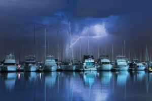
I knew we were in for a pasting when we cleared race point lighthouse and exited Cape Cod Bay’s protected waters. A patchwork quilt of dark blues and frothy whites loomed ahead, and the bow of my father’s modified J/44, Southern Cross, crashed hard into a big, square-shaped wave.
While my dad keeps Southern Cross in fine form, the year was 2004, and weather-prediction models — not to mention forecast-receiving equipment — were nascent compared with today’s options. Case in point: While the National Oceanic and Atmospheric Administration had accurately predicted one tropical storm’s path, it had miscalculated the trajectory of the storm’s closely spaced cousin, the trappings of which we were now “enjoying.” Since pressing on to Canada’s Bras d’Or Lake meant prolonged exposure to significant weather, we reluctantly retreated to safe haven in Provincetown, Massachusetts.
Thirteen years later, contemporary mariners enjoy off-the-shelf access to weather-forecasting models and weather-routing tools. Weather will always change, but today’s tools — including satellite- and Internet-based forecasting that’s integrated with a boat’s multifunction display (MFD) or personal computer (PC), as well as weather-routing software — allow you to sidestep rough weather while minimizing passage times and maximizing fun.

Satellite- and Internet-based forecasts are typically created by taking weather data from official (i.e., NOAA) and private sources and applying post-processing and data analysis to yield proprietary information. Those forecasts are then pushed to users’ satellite receivers or made available for download.
While satellite-based weather forecasts can be received far outside of cellular or Wi-Fi range, services such as SiriusXM Marine require a subscription and a black-box satellite receiver that is networked to an MFD. These receivers are available from major marine-electronics manufacturers and typically need to be built by the vessel’s MFD manufacturer to ensure compatibility.
SiriusXM Marine offers three service levels: Marine Inland, Marine Coastal and Marine Offshore. “The key strengths of SiriusXM Marine are a combination of the continuously updated content and the extensive coverage area,” says Michael Mellett, SiriusXM’s director of aviation and marine services marketing.
SiriusXM Marine subscribers, depending on service level, can view radar weather (including rain squalls); get wave weight, direction and period information; view isobars and receive sea-surface temperatures. A monthly fee allows unlimited use, and forecasts are automatically pushed on board. “Dynamic elements like radar, storm cells and lightning are updated every five minutes, while more stable features such as sea-surface temperature are updated every 90 minutes,” Mellett says.
SiriusXM’s Marine Offshore footprint extends more than 150 miles into the Atlantic and Pacific oceans, the Gulf of Mexico and the Caribbean Sea, according to the manufacturer. For globe-girdlers, Internet-based weather providers such as PredictWind or Theyr are interesting options, provided that the yacht carries satellite-communications equipment and a data plan. Theyr offers three service levels — free, standard and premium — each with different resolution levels. For example, Theyr’s free service offers 0.5 to 1.0 degree of forecast resolution, while its premium service offers 0.01 to 0.04 degrees of resolution, plus advanced-level features including live buoy data and Nexrad radar.

Theyr provides its weather forecasts using the gridded binary (GRIB) concise data format, which is the international standard of the World Meteorological Organization. It also plays nicely with PC-based routing software. GRIB files, either from Theyr or others, are highly compressed compared to normal binary files, requiring less data to download. While GRIB files are typically for PCs, Theyr and Raymarine partnered to let boaters view — via Theyr’s MFD subscription service — Theyr’s standard-precision (0.1- to 1.0-degree resolution) weather on Raymarine MFDs using Raymarine’s GRIB Viewer software. Theyr uses a “pull” model where subscribers access Theyr’s servers through their Raymarine MFD or PC, and then manually select and download a forecast. These files are saved to the MFD’s or PC’s internal hard drive or to a microSD card. “Users can constrain the size of the download from their MFDs,” says Jim McGowan, the Americas marketing manager at FLIR Maritime. “For example, a user can download the weather for Puget Sound, rather than the entire North Pacific.”
While satellite- and Internet-based weather services increase situational awareness, it’s critical to understand that MFDs don’t compute weather- related data. “The service is a read-only graphic layered atop [a] chart and does not sync with navigation/routing systems,” Mellett says of SiriusXM. “The user need[s] to interpret the weather information and make their own decisions about course changes.”

While McGowan hinted that Raymarine MFDs might someday help weather-route to the next port on a cruising itinerary, for now this capability is largely limited to PC-based software, including Adrena and TimeZero (née Nobeltec and MaxSea). “Weather routing today is about speed, safety and comfort,” says Frédéric Algalarrondo, TimeZero’s group sales manager. “We added parameters so that a boater can select the fastest route and avoid the high winds and waves.”
To use TimeZero’s weather routing, a user needs a PC that’s networked to the vessel’s GPS and that’s running TZ Navigator and TZ Routing Module software (sold separately), as well as accurately entered vessel polars (e.g., the vessel’s performance-characteristic metrics). According to Algalarrondo, most cruisers also allow the software — which can read NMEA 0183 data (and Furuno radar and sounder data) — to access their AIS and wind data. Finally, users selectively download a GRIB file with a 16-day weather forecast from TimeZero.
One of TZ Navigator’s more visually engaging elements is the pattern of wavy lines that appears on its chart-plotter page. These lines, called isochrones, indicate the maximum distance the vessel can travel in a 15-minute period based on its polars and forecast conditions. The software calculates and displays the fastest passage through the isochrone, and navigators can use isochrones to explore alternate routes.

While some navigators dig deeply into a GRIB file’s data, TimeZero software includes an auto-routing feature that considers a vessel’s polars and the skipper’s navigating preferences. Using the software’s custom parameters, users can set maximum and minimum acceptable wind and wave heights, and the software plots optimal routing. TimeZero recently added a safety feature that analyzes proposed routes to ensure they’re clear of bricks and buoys, and calculates the route’s safe leeway. Additionally, the software can trigger alarms if, perchance, a vessel wanders toward trouble, and navigators can optimize their departure times based on tides and forecast weather. Even better: While weather-routing software offers a sophisticated analysis of dynamic meteorological events, it’s often designed to work smoothly on minimal hardware platforms. “It’s not much of a system requirement,” Algalarrondo says. “I’ve used it on a $99 Dell tablet, and it works perfectly.”
Alternatively, PC users can download GRIB files from Internet-based weather providers including PredictWind, Global Marine Networks and PassageWeather. Service depending, users can use GRIB-viewing software to consider different forecasts, swell maps, precipitation and cloud-cover maps, and air and sea temperatures. Provided that Internet access exists, PredictWind, for example, offers online weather-routing and departure-planning services, as well as live wind observations from some 20,000 international monitoring stations.
Given that most boaters cruise with MFDs, PCs and modern communications equipment, there’s little reason not to consult multiple oracles.
I wish my father and I had enjoyed these services in 2004, as they assuredly would have enabled us to make smarter departure decisions.
OF BARBS AND ARROWS
A multifunction display or personal computer presents a GRIB file’s weather information as a layer on the chart-plotter page. Each GRIB file contains a series of plotted station circles representing the forecast wind speed and direction at a particular time for a latitude and longitude. The files also indicate cloud cover (darker circles equal cloudier skies). If the forecast depicts only a station circle, winds in that area are forecast to be calm. The presence of wind arrows and barbs indicates the wind’s strength and direction. Each arrow points in the direction from whence the breeze is blowing, and each barb indicates wind speed. If each long barb represents 10 knots, while each short barb represents 5 knots, then an arrow from a station circle at the 3 o’clock position with three long barbs and one short barb means that it’s forecast to blow 35 knots out of the east at that particular time and at that specific latitude and longitude.