
On the evening of November 16, 2016, Leopard, a Chris White-designed Atlantic 57 catamaran, was 400 nautical miles north of the Dominican Republic, sailing south-southeast from Annapolis, Maryland, to St. Martin. Charles Nethersole, a delivery captain with 41 years of experience, was in command, accompanied by crew members Carolyn Bailey and Bert Jno Lewis. Leopard was sailing under autopilot in choppy seas and 18 knots of gusty air with a double reef in her mainsail. Lewis and Nethersole were cautiously double-tucking the staysail from the forward working cockpit while Bailey prepared supper.
The men had just stepped inside — with Nethersole standing watch at the interior helm — when they heard a tremendous roar from the starboard quarter. “The boat got literally picked up,” Nethersole says, positing that they encountered a vortex-triggered pressure drop. “It was like being in an elevator. We went up, and then we just went over.”
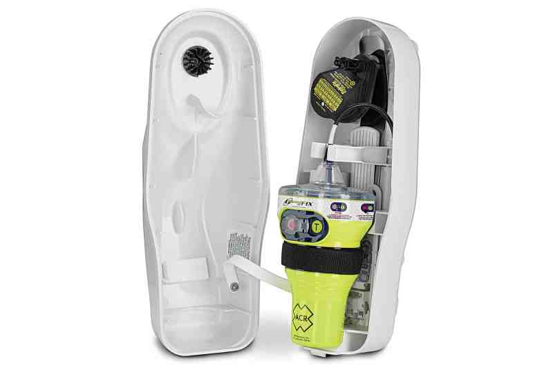
The crew grabbed the ditch bag, immersion/survival suits and life raft, and escaped the water-filled pilothouse for the capsized wing deck. There, Nethersole activated the ACR GlobalFix Pro EPIRB. Several hours later, a U.S. Coast Guard C-130 made visual contact before directing the Aloe, a Greek-flagged cargo carrier on its way to Mexico, to their rescue.
Three-plus months later, Nethersole was inducted into ACR’s SurvivorClub. The Coast Guard deemed the Leopard incident a “textbook rescue,” but the tale highlights the four critical components — alert, locate, track and rescue — of successful search-and-rescue work. Executing those tasks has gotten easier over time and is about to become even more manageable as a long-standing global system evolves in tandem with the emergency tech aboard yachts and other vessels.
In 1979, the United States, France and the Soviet Union created the International Cospas-Sarsat Programme as a free service for mariners. Today, Cospas-Sarsat remains a nonprofit, multinational cooperative, with 43 nations that maintain SAR satellites and air-, land- and water-based assets. Cospas-Sarsat’s various-generation system has saved more than 40,000 lives since 1982.
Even though Cospas-Sarsat involves some complicated technologies, its big-picture scheme is five basic steps: A satellite-mounted transponder “hears” an activated EPIRB’s 406 MHz emergency signal, then passes (or stores and forwards) the information to an Earth-based local user terminal. That terminal passes the signal to a mission control center in the country of the beacon’s registration. The signal is then sent to a center that coordinates rescue efforts.
Cospas-Sarsat’s still-active, first-generation satellite system — Low-Earth Orbiting Search and Rescue (LEOSAR) — uses five satellites to provide global coverage and Doppler-based processing to locate a distress beacon. But this coverage is noncontinuous and requires several orbits, which can take hours; and LEOSAR’s “store-and-forward” signal-sharing scheme can bolster latency.
The current-generation Geostationary Orbit Search and Rescue (GEOSAR) system uses six satellites to provide continuous global coverage and relay 406 MHz signals to the nearest local user terminal. While GEOSAR relays signals much faster than LEOSAR, it can’t use Doppler processing to locate a beacon, so unless the EPIRB shares its position, GEOSAR only knows its registration information and that it’s been activated. As a result, newer EPIRBs come bundled with a global navigation satellite system (GNSS) receiver, allowing the EPIRB to broadcast position information.
Cospas-Sarsat’s next-generation Medium-Earth Orbit Search and Rescue (MEOSAR) system should reach operational capability in 2021-22 and is expected to complement LEOSAR and GEOSAR. MEOSAR consists of 72 satellite transponders and upgraded ground-station components, including significantly higher-performance antennas, and is designed to incorporate the best aspects of LEOSAR (Doppler location processing) and GEOSAR (fast, continuous coverage). The near-global network should be able to triangulate a beacon’s position while offering nearly instantaneous signal detection and transmission.
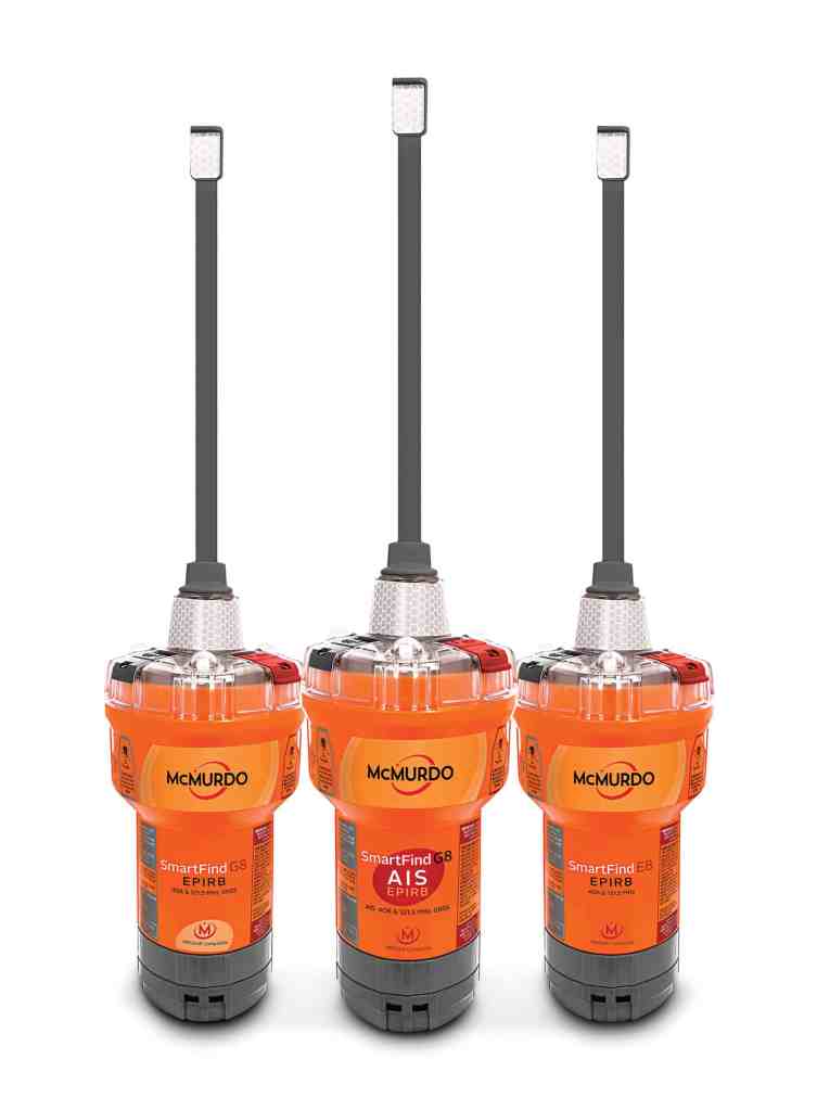
The advent of MEOSAR offers EPIRB manufacturers opportunities to innovate. For example, McMurdo’s FastFind G8 AIS (available in September) transmits four signals: 406 MHz distress signals; GNSS position information; automatic information system (AIS) data, allowing nearby AIS-equipped vessels that are within VHF radio range to render help; and a 121.5 MHz signal. The combination is critical, as previous-generation EPIRBs only transmitted on the 406 MHz and 121.5 MHz frequencies — effective for calling the Coast Guard, but useless for notifying nearby vessels.
Additionally, by 2018, Galileo satellites within the MEOSAR constellation are expected to provide a “return link” signal to activated EPIRBs with multiple GNSS receivers, notifying users that the signal has been received. Sean McCrystal, McMurdo’s marketing manager of search-and-rescue solutions, illustrated the importance of this return link with the story of four Irish mariners whose vessel sank. Convinced that their EPIRB wasn’t working, three of the four attempted to swim ashore and drowned, while the fourth was rescued. “They made their decision because they didn’t think help was coming,” McCrystal says.
While MEOSAR can calculate a beacon’s position without GNSS information, all new EPIRBs sold in the United States after January 2019 will require a GNSS receiver.
As with all technologies, higher adoption levels yield lower prices. According to Nichole Kalil, ACR Electronics’ public relations and media specialist, an EPIRB that fetched more than $1,000 a decade ago can now be found for less than $400 and offers GNSS. “You’re going to spend that or more on your Yeti cooler,” Kalil says.
Cospas-Sarsat’s track record, coupled with the falling prices, means there’s no excuse for failing to carry an EPIRB. After all, while no one wants to activate his EPIRB, properly equipped mariners can take confidence knowing that their beacon will help deliver the same result the Leopard crew experienced.


