If you can clearly read your chart plotter’s screen when the sun shines right into its colorful face, you have transflective technology to thank. I know I said a big thank you when I headed into Long Island Sound aboard our 20-foot Zodiac Medline II to acquaint myself with the Simrad CR42 we’d installed.
The CR42 is one in a series of Sunview units, each model offering a specific set of functions. Our unit, for example, combines GPS/chart plotting with radar and will not accept input from a sounder’s transducer. The CP42 is a dedicated GPS/plotter, and the CA42 is a GPS/plotter-radar-fishfinder combination. All Sunview units run C-MapNT cartography, and all benefit from transflective TFT color LCD screens.
Liquid crystal displays normally get their brightness from behind the screen-light created by the glow of electrical resistance in a filament. Heat, and lots of it, is the byproduct of backlighting. Dissipating this heat is relatively easy when the display is in an air-conditioned pilothouse and a bit more difficult under the hardtop or bimini of an open boat. Place the screen in direct sunlight, and the heat buildup can be harmful, especially if the maker has intensified the level of backlight to battle with the sun. This is the common method of bringing up enough light to prevent the LCD from becoming totally washed out, but the buildup of heat shortens the life of the display, and the operator still can’t see it very well.
Transflective LCDs, on the other hand, use the sun’s own light to brighten the screen. The screen absorbs the sunlight and reflects it back to brighten the images. The brighter the sun, the brighter the display. How long a transflective screen will last in daily use is something I can’t determine in a short-term test, but transflective works as advertised, at least as far as visibility is concerned.
For that reason and others, we’re happy to have the CR42. It’s a top-quality piece of marine electronics that does its job without putting me, or other members of the staff, into fits over abstruse procedures. Start-up is almost as simple as starting the engine. Push the power key, then press the page key to scroll through a guide to enter the owner’s setup. When you’re ready to get into the normal operation, press enter. Use the power key to adjust for daylight or night. From here, start-up is completely automatic, and you’ll know when the CR42 is finished because a position appears. The radar power source is separate from the GPS/plotter and has its own switch. Select the language and turn off the set to save all the data and settings you’ve entered.
Although the CR42 has a built-in world chart, most yachtsmen won’t need it for anything less than a globetrotting adventure. Most, like us, will use C-MapNT mini-cartridges. When you select the chart menu, you get a window that offers chart 1, 2 or C-Map cartridges. Selecting the C-Map cartridges puts the chart reading function into standby mode, which allows you to insert or remove a cartridge. They fit into one or both watertight drawers below the keyboard. The only other time you may remove or insert a cartridge is when the unit is turned off. Pressing the enter key tests the data on the chart to see if it’s valid and free of faults. If you get a defect message, you must remove the cartridge.
The CR42 lets you simultaneously run two charts, one scale differing from the other. Each has its own cursor and individual chart setup, so you may use either one without affecting the other. I look forward to trying this as I become more familiar with the unit.
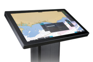
I inserted a cartridge that covers all of Long Island Sound and eastward to Watch Hill, Rhode Island, and pushed the “chart goto” key to display the chart. I zoomed in on my location at Rex Marine in South Norwalk, then pressed the enter key plus 9 to load the chart setup menu. From this menu, I selected the type of information I wanted to display. The CR42 gives you about 40 choices, so you can make the chart as detailed or as clear as you want. I could also have displayed all the information that normally appears on a paper chart of the same area. I chose natural features, landmarks, soundings, lights, buoys, landfilling, north up, true motion (boat moves across the screen) and large chart area (normal re-draw time for pan and scroll). I know this harbor well and enjoyed seeing familiar marks and features on the CR42’s wonderfully clear, sharp display.
If I had not selected landfilling, the display would show only the color blue and not a special color to indicate the land around the harbor. Using the north-up orientation caused the boat’s cursor to head toward the bottom of the screen as I idled out of the harbor. I did this more for practice than anything, and later switched to nav up, which kept my bearing to the destination at the top of the display. If the boat had a fluxgate compass, I would have chosen head up, which automatically turns the chart to place the course over the ground (COG) pointing to the top of the screen. Selecting true motion and having the boat icon move across the screen gave me a sensation of progress to my destination-a marker near one of the islands outside the harbor. If I’d chosen relative motion, the icon would have stayed in the center of the screen and the chart would have moved. This is OK, but I’ll need time to get used to it.
When you turn on the cursor, it becomes the key to your navigation. The nav data that appears on the screen relates to the position of the cursor, instead of your boat. I moved the cursor to my first destination point, pressed goto, then 1 to begin navigation. I picked the next waypoint, Peck Ledge Light, and pressed goto 2 for the second leg. The alarm sounded when I came within a few meters of the first mark. The CR42’s accuracy impressed me then, and again when I reached the second mark.
The word “intuitive” has been thrashed to within an inch of its credibility, but I can’t think of a better word to describe the basic operation of the CR42. A person could get by for quite a long time without consulting the operator’s manual, though he’d miss out on some of the esoteric features. You have five screens from which to choose, a full screen, two halves, quarters or two quarters and a half, with the half on the left or the right. These options let you combine a small chart with a large one, nav data with a chart, radar and chart side by side, etc. The page key lets you scroll among the four pages, and in any of the pages, the window key lets you select which windows you want to show. If you want a quarter of the screen to display the chart, press the window key until the segment you want is blacked out on the menu bar in the upper right portion of the screen. Press enter and the display changes to suit.
Having the radar screen on one half of the display let me compare the location of landmass and navigational aid targets with points on the chart. This juxtaposition gave me a clearer picture than does a radar/chart overlay. On the other hand, if I’d had more time with the overlay system, the question of which is better would become moot.
I look forward to spending more time getting to know the CR42, exploring its wealth of features and navigating in the fog. It seems rugged enough to last a long time at the helm of any boat. So far, only one thing annoyed me: My non-polarized sunglasses muted the screen’s bright display, so I had trouble seeing the finer details.
Price: $7,095 with 18-inch radome and 10-meter cable; $7,795 with DGPS.
Contact: Simrad USA, (800) 426-5585; www.simrad-yachting.com

