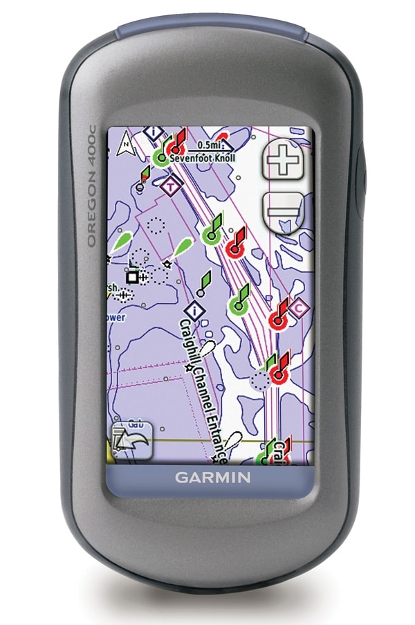
No Calls, Please: Keeping your same old cell phone for awhile? May as well get a powerful handheld touchscreen GPS chart plotter, such as the Garmin Oregon 400c ($600). The bright, 3-inch touchscreen lets you have access to the sensitive GPS receiver and preloaded BlueChart g2 cartography, all in a rugged little package that runs on two AA batteries. Garmin, (800) 800-1020; garmin.com
March 2009: New Electronics
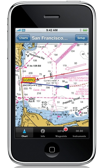
The Plot Thickens: Navionics Mobile brings navigation charts to your smartphone. This is the same level of cartography you may have on your plotter: The charts have all the detail of the company¿s Gold XL9 electronic charts ($99 per region), including wrecks, anchorages, coastal roads and more, and allow the user to pan and zoom seamlessly. Navionics, (800) 848-5896; navionics.com
March 2009: New Electronics
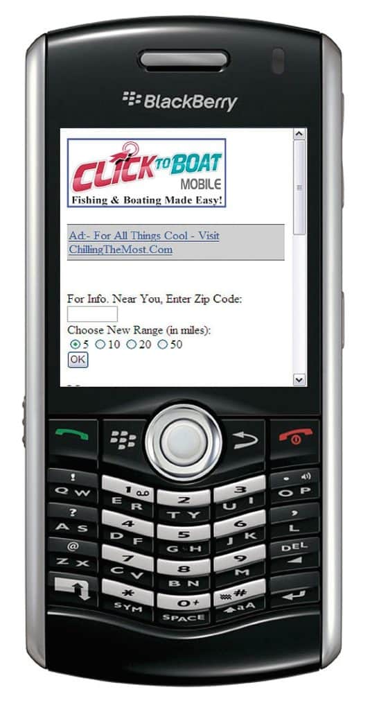
Dialing For Data: Check out ClickToBoat.com for free online resources for boaters, including charts, trip-planning, and shore-side services the data can be uploaded directly to a web-enabled PDA or smartphone. Simply point your device browser at mobile.clicktoboat.com and input your location via ZIP Code to get information about marinas, supply sources, and other information, as well as tips on hot fishing spots. ClickToBoat.com, (888) 628-7732; clicktoboat.com
March 2009: New Electronics
Linked Up: Fugawi X-Traverse ($12 per year) is a web-based system that allows you to transfer waypoints between the iNavX charting system on your iPhone and your Fugawi Marine electronic navigation chart on your PC. The system eliminates the need for cables and backs up data daily. Fugawi supports all kinds of vector and raster charts, including NOAA charts and Navionics Platinum+. And since the X-Traverse is offered at no cost to application developers, there¿s no telling what iPhone apps will be developed to use this powerful link. Northport Systems, (416) 920-9300; x-traverse.com