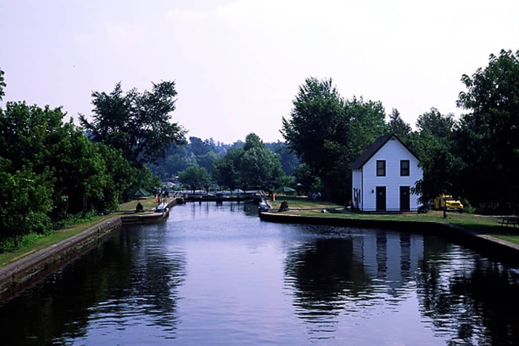
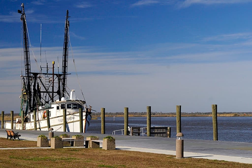
Lock Building
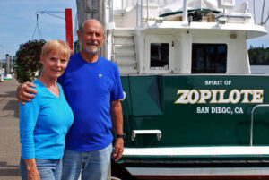
As a young man I dreamed about sailing around the world. I had visions of being at the helm of a William Garden-designed ketch with a bone in her teeth on her way to a South Pacific island. Even as my life cycle progressed from carefree college days to raising a family and building a business, the dream never faded. But at some point reality hits all of us. If I couldn’t live my dream, I would modify it. Instead of circumnavigating the globe, I circumnavigated the eastern half of North America. I was no longer young and carefree; I was a middle-aged guy with a good job, a wife who loved boating and an 11-year-old son who loved the outdoors. So after years of planning, we embarked on an adventure of a lifetime, a one-year boat trip known as The Great Loop.
We first became aware of the loop through the early 1990s television series On the Waterways. This show introduced us to life along America’s great rivers and lakes, and we became intrigued by the idea of exploring our country from the comfort of our boat.
Our plan was to take a one-year sabbatical from work and follow a schedule that provided an endless summer of cruising. Leaving Annapolis, Maryland, in early July, we would head up the East Coast to the Hudson River, the Champlain Canal and Lake Champlain, continuing inland until reaching Montreal. From there, we would explore the Canadian waterways and arrive in Lake Michigan by mid-September. Taking six weeks to head down the rivers from Chicago to the Gulf of Mexico, we then hoped to cruise the Bahamas in late winter before heading up the Intracoastal Waterway (ICW) and returning to our home on the Chesapeake Bay.
Leg One: Annapolis to Montreal Distance: 700 miles
After we left our dock the first day, we were so exhausted from all the planning and preparation that we dropped anchor just a few miles from home to chill out and let it all sink in. Finally, we were on our way and wouldn’t be back for an entire year.
After enjoying Fourth of July festivities in Cape May, New Jersey, we ventured offshore for the 130-mile run to New York. As always, visiting the Big Apple by boat was a thrill, but after a couple of days we were eager to get underway and head up the Hudson River. Traveling north, the mountain scenery was animated with trains weaving up the riverbanks and tugboats heading downriver as we passed Bear Mountain and Bannerman Castle on Pollepel Island. We stopped in the friendly town of Kingston, New York, before reaching our first lock in Troy, 150 miles north of New York Harbor.
Once past Troy, we had a choice of turning west to the Erie Canal or continuing north to Lake Champlain. We chose north and began a delightful two-day, 64-mile trip on the Champlain Canal. Lake Champlain captivated us with its beautiful scenery, protected anchorages and charming towns. Burlington, Vermont, considered one of America’s prettiest towns, boasts excellent restaurants, unique shops and, of course, the original Ben & Jerry’s.
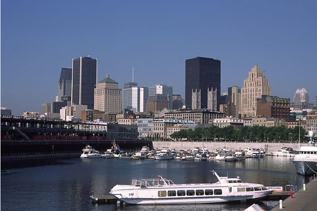
Beckoned by the sounds of French accents from our VHF, we cleared Canadian customs north of Rouses Point, New York, and headed up the Richelieu River bound for Montreal, less than 100 miles away. We stopped overnight in the quaint village of Chambly, Quebec, where we began our indulgent six-week tour of French cafes and bakeries. The gentle Richelieu River abruptly met the busy St. Lawrence, where we turned left toward Montreal. One of our few regrets of the trip is that we didn’t take a side trip to Quebec City, but we have that on our “to do” cruising list. Our slip in Port d’Escale du Vieux in the Old Port of Montreal was close to the action downtown, and the wonderful restaurants, cafes, shops and museums — all with a foreign flair — kept us entertained for days.
Cruising Tips
- Beware of marinas on the Hudson River that are exposed to the wakes of commercial river traffic. We like Liberty Landing Marina in Jersey City, New Jersey, for its protected docks and proximity to water taxi service to the Big Apple.
- Learn proper lock procedures. Wait for the green light before entering, and follow the lock keeper’s instructions about where to tie up. Don’t fasten your line to your cleats; lines need to run free as the water level rises or falls. Wear a life jacket while inside the locks.
- Have a valid passport for all U.S. citizens entering Canada and/or a certified birth certificate for children 15 or younger. A good source of information is gocanada.about.com.
Leg Two: Montreal to Lake Michigan Distance: 800 miles
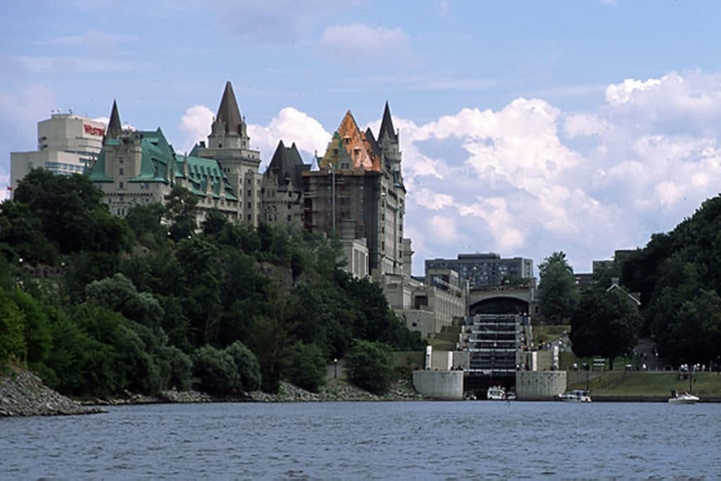
From Montreal it was a three-day river trip to Ottawa, the capital of Canada. Ottawa’s dramatic entranceway features eight consecutive step locks that raised our boat 80 feet from the Ottawa River to the city level, and once there, we followed the river through the scenic city to Dows Lake. We took advantage of the attractive bike paths along the river to visit downtown and see the magnificent Parliament building.
Ottawa’s step locks are the beginning of the historic 125-mile Rideau Canal system that leads to Lake Ontario. Many of its 47 locks were built about 175 years ago and are still operated by hand. We took a week to transit this magical waterway, spending nights tied up along lock walls or anchored on Rideau Lake. At the suggestion of locals, we threaded our way through the entrance to Morton Bay, a well-protected anchorage surrounded by granite cliffs decorated with tall pines. As the moon rose over the horizon and the wail of a distant loon broke the evening silence, we knew we would never forget this enchanted place.
The Rideau Waterway ends just above Kingston, Ontario, an excellent place to stop and enjoy city life. We chose Confederation Basin Marina for its convenient location downtown. Dinner at Chez Piggy Restaurant and Bar was very French and very good, but an even bigger highlight was Vandervoort’s Hardware, where you can find just about anything: dock lines, charts, underwear, courtesy flags and much more.
We needed to poke our nose out onto Lake Ontario to reach Trenton, where the 240-mile Trent-Severn Waterway begins, and it was a rude awakening to Great Lakes cruising. Gusty winds and steep seas made for an uncomfortable ride until we reached the more protected Bay of Quinte. Soon, however, we were traveling from lock to lock and meeting fellow “loopers” on the tranquil Trent-Severn. Transiting the hydraulic Peterborough Lift Lock was a thrilling experience as our boat was lifted 65 feet in a chamber of 1,700 tons of water. A similar thrill was experienced at the Big Chute, where our boat was carried across 600 feet of rocky terrain on a giant marine railway.
Our route took us from this serene waterway to the rugged cruising grounds of the Thirty Thousand Islands of Georgian Bay and the wilds of the North Channel. We spent two weeks exploring these magnificent waters, kayaking and hiking during the day and building campfires on uninhabited islands at night. The water was clear, the skies were blue and the trees were bent hard over from the relentless, wind-swept winters. When looking back at our entire one-year trip, this was one of our favorite destinations.
Cruising Tips
- Take your time and enjoy the small towns along the Canadian waterways, spending your nights tied up along the lock walls where you’ll meet fellow “loopers.”
- Buy the series of Canadian Hydrographic Service Small Craft Charts, sometimes called “strip charts” (we bought ours in Montreal at McGill Maritime Services). The charts are aligned with the waterway’s orientation instead of being north-up. Follow them carefully in Georgian Bay and the North Channel. When in doubt, slow down. There are no soft bottoms up here.
- When traveling the canals and locks, cover your fenders with heavy-duty garbage bags to keep them clean from the scum along the lock walls.
Leg three: Michigan to Mobile, Alabama Distance: 1,600 miles
After checking in with U.S. Customs on Drummond Island, Michigan, we headed for Mackinac Island, the popular vacation destination 40 miles away. Known for its horse-drawn transportation (no cars are allowed except for emergency vehicles), it is technically part of a city but feels like a village with clean, noise-free air. Breakfast or afternoon tea at the legendary Grand Hotel is a must, as is a tour of Fort Mackinac.
All this civility came to an abrupt end during our 45-mile crossing to Beaver Island. Although the weather forecast called for mild conditions, as we approached the Straits of Mackinac we found ourselves in building seas and increasingly gusty winds. By the time we reached Grays Reef, punishing 8- to 10-foot seas were coming from several directions. Finally, we landed on Beaver Island and found our way to the Shamrock Restaurant and Pub to lick our wounds and embellish our stories with others who had been out in those miserable conditions.
Working our way south we discovered the charming Michigan communities of Harbor Springs, Leland, Pentwater and Saugatuck, each with its own friendly personality. High white-sand dunes stood out against blue skies. Sturdy breakwaters and lighthouses led the way to protected harbors. The clear, fresh waters were alive with whitefish, trout and yellow perch.
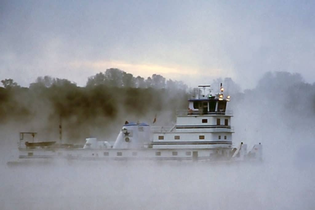
After two weeks we arrived in Chicago, where we immersed ourselves in city life and prepared for our six-week, 1,200-mile trek down the rivers. With changing water levels, heavy commercial traffic, river debris, lock delays and sections of scarce fuel, this leg can be more adventure than vacation, but for every challenge, there was an equal reward of discovery. The colorful, local knowledge at the series of anchored barges known as Hoppies Marine Services on the Mississippi. Paducah, Kentucky’s history-filled floodwall murals. The Land Between the Lakes National Recreation Area in western Kentucky. Elvis Presley’s birthplace in Tupelo, Mississippi. Catfish night at Bobby’s Fish Camp in Alabama. From the Illinois to the Mississippi and from the Ohio to the Tennessee-Tombigbee Waterway, we were seeing America from her own backyard.
Cruising Tips
- Prepare for unexpected delays at locks because commercial traffic has priority over recreational boaters.
- Buy a copy of Quimby’s Cruising Guide for marina locations and safe anchorages.
- Learn the correct “whistle” signals to communicate with towboat captains when passing or approaching. Call on your boat’s VHF and ask the captain on which side he wants you to pass. “Pass me on the one” means to pass to the towboat’s starboard side. “Pass me on the two” means to the towboat’s port side.
- Learn the basic inland navigational rules. Going downriver, red markers are to your port and green are to starboard. Buy the inland chart books that cover your entire route. They’re cheap compared with a damaged prop or worse.
Leg Four: Mobile to the Bahamas and back Distance: 1,600 miles
Six weeks was a long time on the rivers, and we were happy to see the open blue water and white-sand beaches along the barrier islands east of Mobile, Alabama. Pensacola, Panama City and Apalachicola were favorite stops along Florida’s panhandle, but even more interesting were the rivers and small towns of the big bend that turns southward toward Florida’s tip. Time stands still here, and the towns of Steinhatchee and Yankeetown are reminders of what Florida must have been like 50 or more years ago. Taking the time to explore the Steinhatchee, Withlacoochee and Crystal rivers, we were rewarded by their natural beauty and abundant wildlife.
In contrast, the high-rise buildings and McMansions along the busy waterways of Tampa, Sarasota and Naples were signs of today’s Florida, and we found ourselves moving briskly south to reach the Florida Everglades. (At this point, many “loopers” cut across Florida on the Okeechobee Waterway, skipping southern Florida.) An overnight visit to the Rod and Gun Club in Everglades City was a trip back in time because the walls are filled with photos and newspaper clippings of its famous clientele. Meandering among the Ten Thousand Islands National Wildlife Refuge, we anchored off sandy beaches and met adventurous kayakers exploring the 100-mile-long Wilderness Waterway.
Arriving in Key West, we discovered a different form of “wild life” and thoroughly enjoyed the change of pace. January is an ideal time to be in the Florida Keys, as the temperatures remain in the low 80s while other parts of Florida experience frost warnings. We waited in Fort Lauderdale for the right conditions to cross the Gulf Stream, and after a calm 50-mile passage to Cat Cay, we began a two-month odyssey of the Bahamas. It was February, which can be chilly in the Abacos, so we first headed to the Exumas, eventually reaching Georgetown, where we stayed for three weeks and enjoyed the company of fellow cruisers. As early spring approached, we headed to the more populous Abacos, spending two weeks cruising these delightful islands before heading back to West Palm Beach. Again looking back at our entire trip, the Bahamas were our favorite part along with Georgian Bay and the North Channel.
Cruising Tip
- Florida’s Big Bend is recommended for those looking for natural wildlife, not exciting night life. If your boat’s draft exceeds 5 feet, you’ll be better off skipping this area and heading to the west coast of Florida.
- Crossing the Gulf Stream requires waiting for the right conditions. Do not attempt the crossing if winds are out of the north.
- When traveling to the Bahamas during winter or early spring, head for the Exumas first, then the Abacos. The Abacos can be cool and windy in the winter.
Leg Five: West Palm Beach to Annapolis Distance: 1,050 Miles
After two glorious months in the islands, arriving in West Palm Beach on a busy weekend was like landing on another planet. We had no choice other than to adapt to the quickened pace and crowded waterways. By now we were used to the freedom of our live-aboard lives, and we weren’t overly eager to return to our former lifestyle. Thus began our leisurely two-month trip up the ICW to our home port of Annapolis.
Hopping from one Florida community to another, we spent extra time in both St. Augustine and Fernandina Beach. The architecture and historical significance of these charming cities were intriguing, and we were attracted by their cultural offerings. After leaving Fernandina Beach, we dropped our hook off nearby Cumberland Island in Georgia, where we hiked across the island in the company of wild horses.
Today, many parts of the ICW are experiencing serious shoaling problems, so we talked with fellow cruisers at critical stops for local advice. In some cases, we adjusted our schedule to pass through these areas on a mid- and rising tide. When conditions were favorable, we would run outside, avoiding trouble spots altogether. But since we had time, we mostly enjoyed poking along the waterway at displacement speeds.
Our favorite stops along the way included South Carolina’s Beaufort (pronounced BEEW-fort) and Charleston as well as North Carolina’s Southport, Beaufort (pronounced BO-fort) and Oriental. At this point, there are two routes north: the Dismal Swamp that goes through a wildlife refuge or the more direct Virginia Cut. Each winds up at Mile Marker 0 in Norfolk, Virginia.
From Norfolk, we slowly worked our way up the Chesapeake Bay — familiar ground for us. These last 100 miles were a time of reflection as we began to realize how this trip had changed our lives and given us a better appreciation of this magnificent part of the world we live in.
Cruising Tips
- When traveling the ICW in Florida, pay close attention to the manatee warning signs that require slowing down.
- The magenta line showing the ICW route on your paper and e-charts is no longer accurate in many areas, so follow the actual navigation aides to stay in the channel.
- Unless you have to, don’t rush your trip on the ICW. Slow down and enjoy its many unique towns and secluded anchorages.