Christopher Columbus was already a master navigator when, on May 30, 1498, he embarked on his third voyage of discovery. This expedition, however, which ultimately carried his six-strong fleet to Venezuela’s Paria Peninsula, provided lessons in magnetic declination and governing practices. As he sailed west, Columbus noticed that the angle between north, as registered on his magnetic compass, and north, as measured by his lodestar, was changing. Columbus likely understood that this angle fluctuated over time and with his latitude and longitude, and he definitely understood that navigational ambiguity wouldn’t be a crew-pleaser, so he factored corrective measurements into his dead-reckoning navigation.
While his tactic worked, contemporary heading sensors greatly simplify navigation. For example, mechanical gyrocompasses, nine-axis compasses and GPS receivers can deliver heading or course-over-ground (COG) data to networked instrumentation. However, these solutions have their drawbacks. Gyrocompasses require regular maintenance, nine-axis compasses deliver modest accuracies of 1 to 2 degrees, and GPS requires positive boat speed to render COG information.
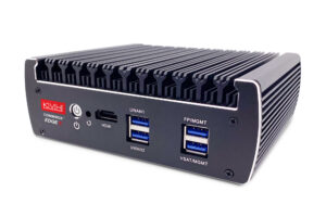
Furuno’s maintenance-free, solid-state SC33 satellite compass delivers heading, roll and pitch data that’s accurate to plus or minus 0.4 degrees, as well as position data that’s good to 10 feet, and downstream instrumentation, even with 0.0 knots of boat speed.
Much like its predecessor, the SC30, the SC33 employs a rectangular, semi-T-shaped radome (see “Physically Speaking”). This houses two in-line Global Navigation Satellite System (GNSS) receivers that allow the SC33 to receive signals from GPS (United States), Glonass (Russia), Galileo (European Union) and QZSS (Japan) satellite constellations. Also inside are a three-axis rate gyroscope, acceleration sensors, a thermometer, a barometer and a microprocessor. The compass’ dual in-line GNSS receivers calculate the vessel’s azimuth heading, while its three-axis rate gyroscope and acceleration sensors allow its internal processor to calculate pitch and roll.
All told, the SC33 delivers heading and position data — speed over ground, course over ground and rate of turn — and stabilized roll, pitch and heave data to the vessel’s networked navigation system via its NMEA 2000 networking cable. Alternatively, Furuno’s IF-NMEA2SC gateway ($195, sold separately) allows the SC33 to deliver data to legacy NMEA 0183 networks.
“The difference between a GPS receiver and a satellite compass is that satellite compasses use multiple receivers,” says Eric Kunz, Furuno’s senior product manager. The SC33 measures and compares the slight time differences — measured in the billionths of a second — between when its two antennas, situated a foot apart, receive signals from the same satellite(s).
“The underlying technology is the phase relationship between the two antennas,” Kunz says. The SC33 compares these phase differences once per second (1 hertz), and its processor pulls data from its gyro and acceleration sensors, which operate at 100 hertz to interpolate vessel movements that unfurl between these reporting intervals.
“This system doesn’t use the Earth’s magnetic field,” Kunz says, adding that an SC33 will maintain heading accuracy under a steel bridge, provided that it can receive signals. “It’s using known positional information from an outside source — the satellite — so it’s not susceptible to magnetic interference from big ships or bridges.”
Like its predecessor, the SC33’s two GNSS receivers gather signals from at least five satellites to generate position, speed and heading information, an initial process that takes roughly 60 seconds. But unlike the SC30, the SC33 can drop as many as four of these satellites once it has attained its initial fix.
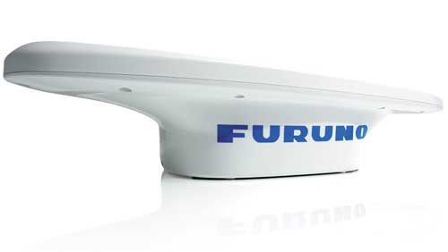
Physically Speaking
“GNSS satellites have two- to three-hour orbits, so satellite compasses are constantly losing satellites and picking up new ones,” Kunz says. These satellites use polar (aka “birdcage”) orbits, enabling global service, even if the SC33 is down to a single bird. “It’s [more advanced] technology than we’ve had before,” Kunz adds, describing the SC33 as an evolutionary advancement in speed, reliability and NMEA 2000 networking capabilities.
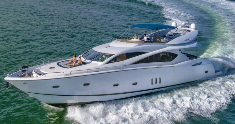
Once networked, the SC33’s navigational data assists the yacht’s autopilot, chart plotters, radars and sonars, especially in rough seas.
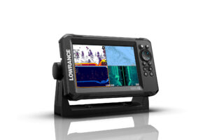
“The SC33 provides heave compensation to deliver a stabilized vessel-height position,” Kunz says. This eliminates saw-toothed imagery on fish-finder and sonar screens. Additionally, the SC33’s heaving compensation capability eliminates the need to use a fish finder’s bottom-lock display mode, which can mask details and distort target returns.
With networked radars, accurate heading and stabilized vessel-movement data enable advanced-level capabilities. For example, Kunz says, higher-end Furuno radars have True Trails functionality, which delivers stabilized echo trails of all acquired targets. “With stabilized trails, you can see exactly where these boats have come from … and you can extend [their] heading in front of [their] True Trails,” Kunz says.
Cost is another benefit: First-generation satellite compasses fetched $15,000, while the SC33 weighs in at a comparatively modest $2,595.
As with all marine electronics, satellite compasses have their inherent downsides, and the SC33 is no exception. For example, much like satellite-communications or television antennas, satellite compasses can suffer from signal blockage or error-inducing “multipath” (read: ricocheting) reception if they are installed near superstructure or other antennas. However, according to Kunz, multipath issues can be much better filtered with the SC33 than with the legacy SC30.
“This antenna is more liberal with where you can put it,” he says.
So, if you want to unlock advanced instrumentation features and enjoy better autopilot performance, Furuno’s SC33 could be a solid choice.
As for Columbus, while there’s no question that a better heading sensor would have quelled his crew’s offshore anxieties, it’s unclear if it would have spared him the ignominy of being deposed as Hispaniola’s governor and returning to Spain in manacles — even if it would have again proved useful during his fourth and final voyage.