I learned that foggy and unfamiliar landfalls required straight-faced concentration. My dad, a physicist, had tools limited to paper charts, loran and radar. Flash-forward 30-plus years, and technology has usurped these old-school implements. Today, while all marine technology is improving rapidly, electronic cartography and multifunction displays are outpacing nearly everything else.
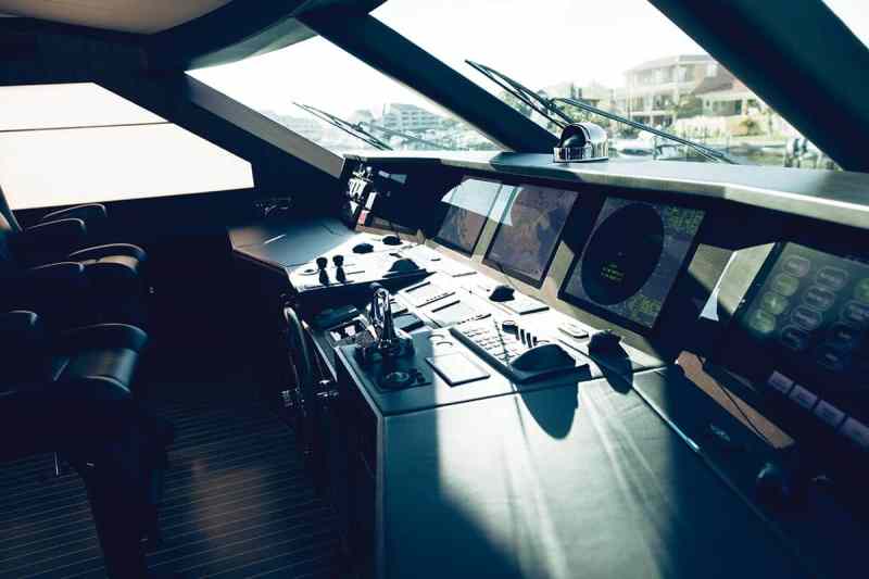
MULTIFUNCTION DISPLAYS
Query any multifunction display manufacturer about its latest innovations, and you’ll hear about increased processing power, greater integration and bigger touch-screen-enabled displays. Now-generation MFDs are using the same off-the-shelf processors that drive today’s lightning-fast tablets and smartphones, allowing manufacturers to build more capable, feature-rich MFDs.
“We’re seeing more features that are built into MFDs as standard equipment,” says Jim McGowan, U.S. marketing manager for FLIR and Raymarine. “Years ago, this all required individual modules, which added to the costs. Now, this functionality is integrated into the MFD.”
While the big-picture market trend is focused on building larger, more powerful and cost-effective MFDs, there’s a parallel undercurrent developing more pared-down, smaller-screen solutions. Specifically, Garmin and Simrad have created compact devices — albeit of decidedly different natures — that are ideal as complementary screens aboard larger yachts.
Garmin’s GNX 120 and GNX 130 large-format instrument displays (7 and 10 inches, respectively) can present a wide range of data in numerical and graphical form (i.e., linear graphs, but no pictures) and are easy to read in direct sunlight and at night. These networkable screens evolved from sailing-specific uses, but they can also display information like depth, water temperature and (some) engine data. Additionally, users can customize the backlight color and overall color palette, and the compact size of these displays allows them to be installed easily around the boat.
“We’re seeing more powerboaters gravitate to these displays than we expected,” says Dave Dunn, Garmin’s senior manager of marine sales and marketing. Simrad took a different tack with its GO chart plotters, available in 5- and 7-inch models with various hardware and software options. All of the models have embedded GPS, sounder processors and autopilot controls. GO plotters are not networkable, but they have NMEA 2000 compatibility and Wi-Fi connectivity, which allows them to access networked information and receive cloud-based updates, and they can display a library of cartography.
“We build a lot of power into our GO series,” says Steve Thomas, Simrad’s product line director, who explained that these plotters can wear many different onboard hats. For example, they can be used as sunlight-viewable depth, speed and temperature displays, as co-pilot screens that tackle applications ranging from autopilot controller to entertainment server, or as dedicated CZone displays. GO series plotters can also serve as dedicated ForwardScan forward-looking sonar displays or as backup chart plotters. Customizable data bars allow users to augment existing (or defunct) gauges while enhancing overall functionality.
Both Garmin’s and Simrad’s “little glass” screens are interesting solutions for owners who want to add informational awareness, rather than spec’ing additional full-feature MFDs.
“We’ve enhanced the data sets to be more than just a flat file with your boat on the chart.”
Ken Cirillo, C-Map by Jepsen
ELECTRONIC CARTOGRAPHY
While MFDs have been evolving rapidly, so too has the cartography that provides their informational backbone. In fact, today’s cartography is so rich in features that most boaters only scratch the surface of what’s possible. This is changing, though, with the rise of improved user interfaces and integrated data sets that provide a cornucopia of information.
User-generated cartography allows boaters to use their sonars to gather high-resolution bathymetric data, which they can use locally or upload to a cloud where it’s aggregated and incorporated into an updated chart. Historically, the crux has been uploading this data; most MFDs are limited to marina Wi-Fi networks. Navionics founder Giuseppe Carnevali says that this is poised to change immediately, thanks to some clever thinking (see “Media Metamorphosis, page 70”).
Additionally, electronic charts come loaded with data, from full vector and raster information to aerial and satellite photos to information concerning shoreside services and amenities. This data can include location-specific fuel prices and slip availability, current vectors and weather information.
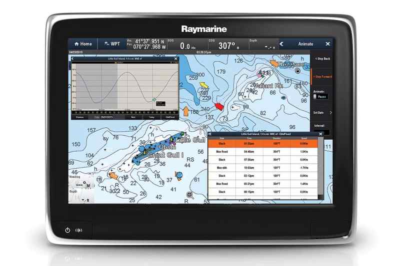
“We’ve enhanced the data sets to be more than just a flat file with your boat on the chart,” says Ken Cirillo, C-MAP by Jeppesen’s senior manager for light marine sales in the Americas.
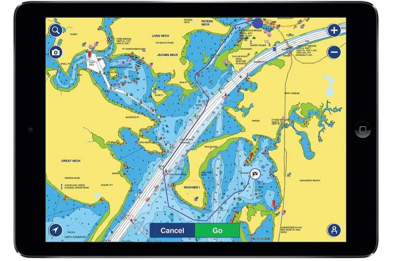
Both Navionics and Jeppesen recently rolled out new self-routing features (think of a car navigation system) that are available on mobile devices, MFDs or both. “The computer can do more work faster than a human brain,” Carnevali says. “It frees up more time for you to [fine-tune your navigation], especially in congested areas. Coming up with an algorithm to do this took us only four years!”
Media Metamorphosis
Given the massive inroads that user-generated cartography has made, this technology clearly represents the path forward for high-resolution, boater- specific charts, but there’s a finicky missing link: an MFD’s inability to go online outside of Wi-Fi. Navionics has created a mobile-device software link that creates a seamless connection between a cellular-enabled mobile device and a yacht’s MFD. “Manufacturers are building Wi-Fi into their MFDs, but to go [online] is challenging,” says Navionics founder Giuseppe Carnevali, referring to typically sluggish marina Wi-Fi speeds. “But if you use [our] mobile-device link, the MFD syncs with the phone, and the phone syncs with the cloud.” As of this writing, Raymarine is the only MFD manufacturer providing this feature, but Navionics has offered this software technology to all MFD manufacturers.
The dividends from these self-routing features are handsome for both simplifying navigational duties and increasing margins of error. For example, Navionics received two reports from boaters who lost their electronics in coastal storms, but they safely navigated home using their mobile apps. Still, Carnevali and Cirillo both stress that algorithms will never replace the need for alert, competent navigators.
Electronic cartography is evolving rapidly, but it’s critical to understand that this is the result of better software and hardware. “Larger central-processing units that can do more allow us to add more content,” says Cirillo, who explained that cartography kits provide all the information that the MFD needs to perform high-level tasks.
“We’re at the beginning of a change that’s comparable to the shift from paper to electronic navigation,” Carnevali says. The next step involves creating a seamless ecosystem of navigational hardware and software that can be used anytime and anywhere. Stay tuned.


