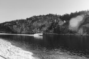
As a kid, I would accompany my dad to our local chandlery to buy paper charts. He’d spend his winter weekends with them, planning our cruises. Come July, these charts would appear on board, with waypoints and routes drawn in pencil.
This system wasn’t seamless, but there was something magical about sitting next to my dad at the nav station, discussing the day’s agenda.
Flash-forward 40-plus years, and Furuno has combined the convenience of electronic navigation with the practicality of a chart table.
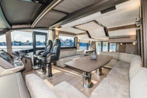
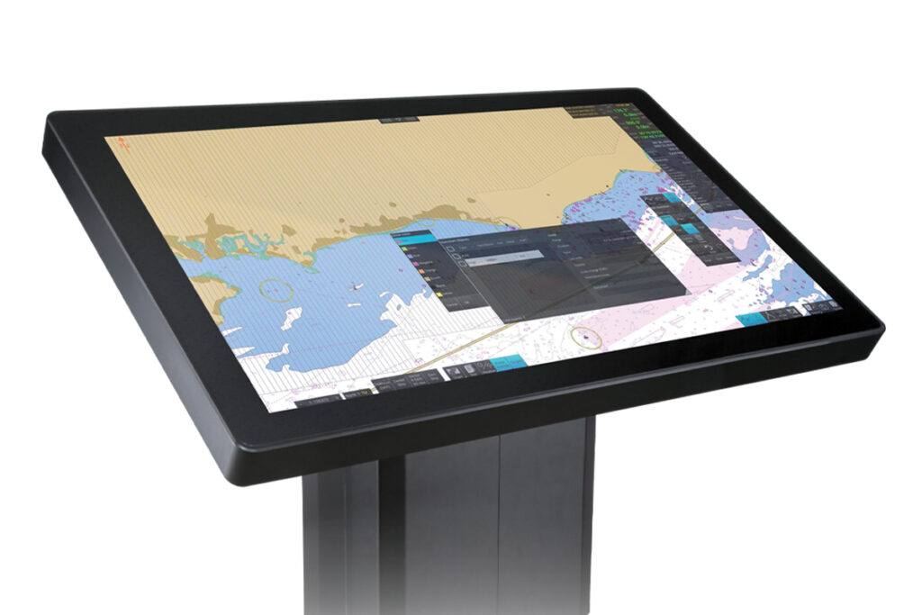
Modern electronic charts simplify navigation, but it can be challenging to plan a cruise on a relatively small screen. Enter Furuno’s PS-100 planning station, which is available in three large screen sizes, including a pedestal-mounted 55-inch display. This setup can overlay automatic identification system, radar and weather information atop cartography, giving navigators the convenience of electronic navigation with the elbow room of an old-school nav station.
The PS-100 is primarily designed for large vessels that navigate using International Hydrographic Organization-approved electronic charts on ECDIS (electronic chart display and information system) equipment, rather than for recreational navigation gear like multifunction displays. That said, some large yachts sail with IHO charts and ECDIS equipment, while other boaters can plan their cruises on a PS-100 and then manually transfer routes into their Furuno NavNet TZtouch MFDs.
“The PS-100 is meant to be an addition to, or an enhancement to, an existing Furuno bridge system,” says Bart Disher, Furuno’s commercial business development manager, referring to ECDIS equipment. “It’s a way to easily look at a much larger screen, separate from the navigation bridge, to do the planning.”
PS-100 systems consist of a display networked via USB and DisplayPort cables to a downstream PC tower, which, in turn, is networked to the vessel’s ECDIS via Ethernet. Planned routes are created on the PS-100’s display and sent to the ECDIS via Ethernet, while AIS (and tracked targets), radar and weather information is sent from the ECDIS to the PS-100 via this same connection.
Users have a choice of three standard screen sizes: 32-inch, 43-inch and the pedestal-mounted 55-inch. Alternatively, users can spec their own screen. The three standard displays are built by Hatteland Technology. “We have a long-running relationship with Hatteland,” Disher says.
All three of the standard monitors have 4K image resolution, which allows them to display high-definition electronic navigation charts. The 32- and 43-inch displays can be mounted at the helm or on a bulkhead, or they can sit on a desk like a computer monitor. The 55-inch display can be mounted or fitted in a pedestal that presents the screen at a fixed 45-degree angle or that articulates from horizontal to 30 degrees using electric motors.
All PS-100 systems use identical PC towers, which are also built by Hatteland to Furuno’s specs and run on Furuno’s software. Each PC comes with a ninth-generation (or newer) Intel Core i7 processor, an Nvidia Quadro P2200 (or later) graphics board, 16 gigabytes of RAM, and a 240 GB solid-state hard drive. In terms of connectivity, the towers also have HDMI ports, a DisplayPort, a USB type A port, an RS-422/485 port, an RS-323C port, an Ethernet port and an analog input.

While it’s tempting to think of PS-100 systems as MFDs on steroids, Disher says one distinction is that while PS-100s can display networked radar information, they can’t control the radar’s functionality, such as operating modes or zoom levels. Instead, he says, PS-100s are intended to be large and eye-pleasing planning stations that let users explore points of interest, compare route options, measure distances using an electronic divider and create routes. PS-100s also have three sets of electronic bearing lines and variable range markers for measuring bearing and distance, and they can store and transfer up to 300 routes and 200 charts with their networked ECDIS.
PS-100 systems can also run NAPA’s cloud-based Voyage Optimization software, which requires Furuno’s optional Service Gateway Gate-1 automatic chart-update system. This software optimizes route planning based on each vessel’s performance characteristics to bolster safety and reduce fuel consumption. While NAPA’s Voyage Optimization considers factors including weather routing, fuel consumption and emissions, Disher says the system uses math, not AI, to optimize routing.
In addition to route optimization, Furuno’s optional Gate-1 system also acts as an automatic chart-downloading and updating service. This, Disher says, transforms the manual process of updating IHO-approved electronic navigation charts into an automatic service that compares available updates with the vessel’s licensed cartography library. It then automatically downloads any needed updates via the vessel’s satcom system and shares these with the ECDIS system.
Disher says boat owners and captains who navigate using MFDs can create routes on a PS-100 and save them in MFD-friendly formats onto a Furuno USB dongle, and then manually transfer this information to their MFD. While the process isn’t seamless, Disher says it allows navigators to bring PS-100 routes into Furuno’s NavNet MFD ecosystem.
Also, Disher says, Furuno is exploring the possibility of enabling NavNet MFDs to navigate on IHO-approved charts. If this happens, PS-100 owners could potentially share routes with compatible Furuno-built MFDs via Ethernet.
Adding additional equipment requires analysis. PS-100s require a large helm to accommodate the display, or bridge space for a pedestal-mounted screen. Still, the system would be a welcome addition to most yachts for planning routes, replaying past voyages, briefing crew and owners, or showing guests the day’s agenda. A simple tap flips the screen’s orientation, allowing for group discussion and collaboration.
Overall, Furuno’s PS-100 can provide the best of all worlds: accurate and up-to-date cartography displayed atop spacious screen real estate that makes route planning a pleasurable experience.