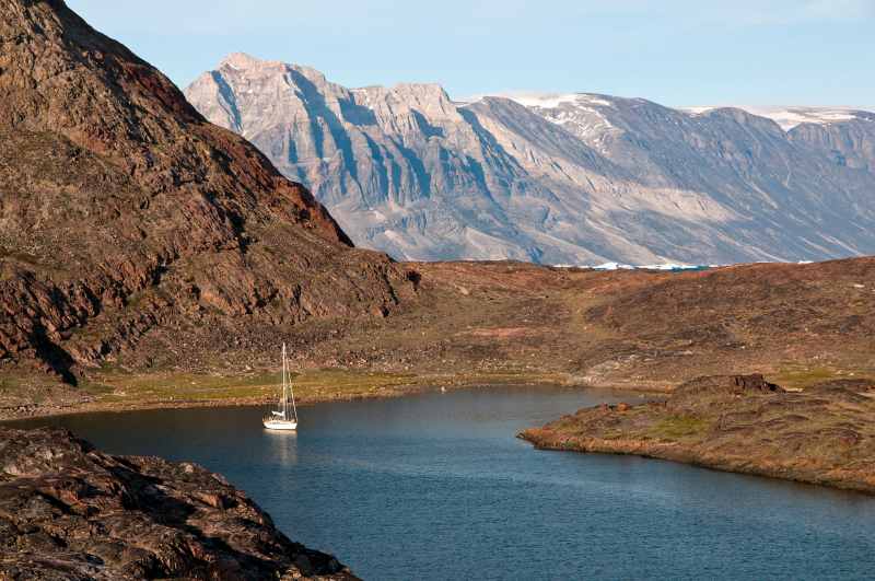


On the coast of western Greenland (71 degrees 15 minutes north latitude), we realized we’d been stalking the ghost of the great artist Rockwell Kent. From the Igdlorsuit anchorage off Ubekendt Ejland we looked across Umanak Fjord at mountains well over 6,000 feet high with serrated crowns surrounding snowy cirques. Wide rivers of glacial ice wound among them. Kent transferred this grandeur onto his canvases while based on Illorsuit. He was a sailing adventurer at heart in search of places with soul- uplifting beauty and mind-cleansing severity; we had already followed in his wake in the channels of Tierra del Fuego, Maine and Alaska. In 1929, he sailed for Greenland, where the 33-foot Direction dragged anchor and wrecked south of Nuuk.
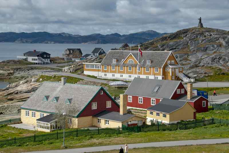
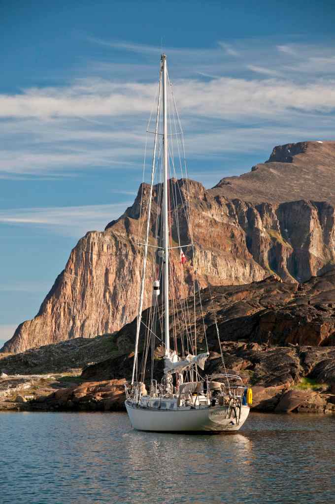
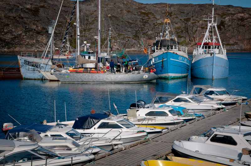
Our 750-mile sail from St. Lewis Sound in Labrador was less eventful than Kent’s. In June 2013, a double-barrel system of lows approaching Greenland gave our Mason 44 Frances B a bracing cold taste of sailing far north. For several hours, we stayed hove-to under a scrap of canvas with the mainsail reduced to its fourth reef. Except for a shredded Bimini top, we made it intact to an anchorage in Buksefjord, the first of the fjords along the southern approaches to Nuuk 30 miles to the east. Kent, on the other hand, had to trek over ruthless terrain to find help and save his stranded companions. Since his time, Nuuk, the capital of Greenland, has grown into a modern city of 16,000 people. Visiting yachts rafted alongside small ships in its crowded harbor, bunched on Kutterkaj wharf under a precipitous cliff.
Our next major destination was Disko Bay, renowned for the thousands of icebergs calving from a tidewater glacier near Ilulissat on the mainland. Light southerly airs brought thick fog, although the watery sun painted a large halo veiled in swirling vapors right overhead. The view ahead cleared a day later. Toothed mountains sharply defined the land off to starboard. Soon the wind piped up from the north, raising a steep chop. A tack toward the shore, plus some help from the engine, brought the boat right to the entrance to Sisimiut. The port’s inner basin was packed tightly with fishing boats, forcing us to anchor off. We managed to attach Frances B to the bottom firmly thanks to our 300 feet of chain. Later, I wished we’d carried 500 feet of chain — some of the anchorages are very deep, even just yards from the shore.
The inner passage through rocks, islets and islands begins north of Sisimiut and leads all the way to Aasiaat, a port on the south side of Disko Bay. By then, we had crossed the Arctic Circle.
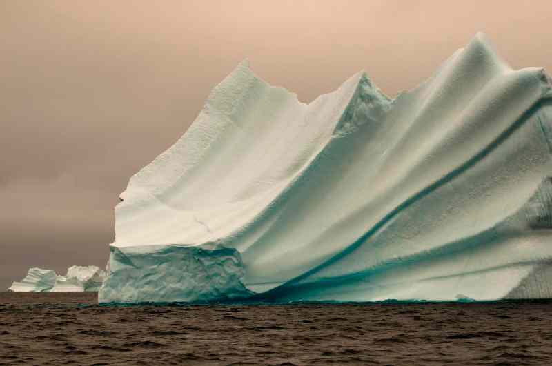
The darkness of the nights vanished, helping with navigation in poorly charted waters pestered by chunks of ice. In the inner passage, icebergs hundreds of feet high, with drafts measuring four to six times their height, sat aground along the edges of the shoals. They glistened, sweating meltwater in a heat wave of around 40 degrees Fahrenheit.
In Aasiaat Harbor, yachts rafted alongside derelict fishing boats tied to the floating wharf of a shipyard. Old Greenland hands bring their yachts here instead of Nuuk; the weather is better. The Seamen’s Home next door has a restaurant with Internet and laundry service, and the fueling float offers deep water. After swinging by the charter tall ship Rembrandt van Rijn, Frances B boldly headed out in pursuit of whales blowing outside the harbor. Fog rolled in suddenly. With our bow nearly invisible, the still-distant icebergs became a threat. We made a U-turn into a bay on Manitsoq Island, our radar, depth sounder and paper chart assisting with navigation by a poorly detailed digital chart. A bleached string of whale vertebrae marked a pebbly beach landing.
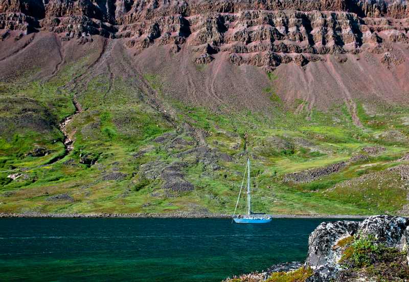
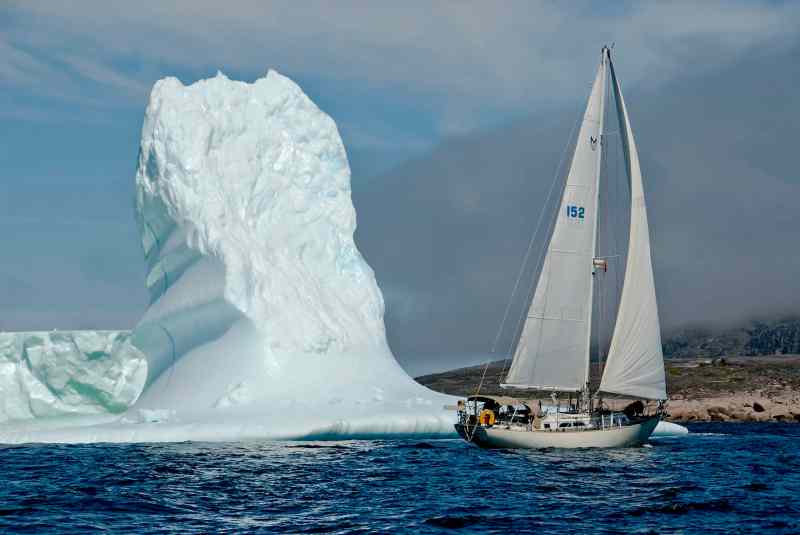
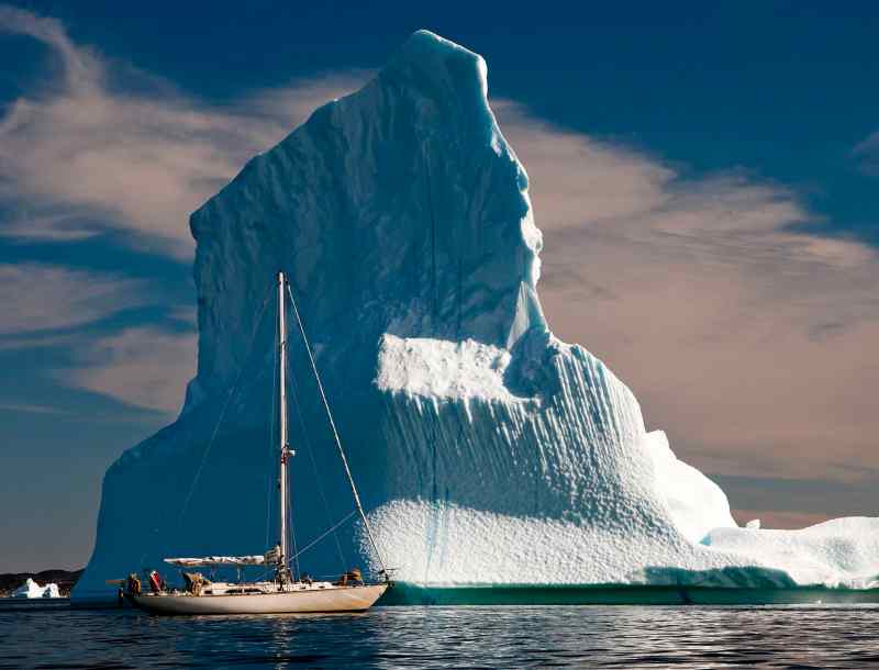
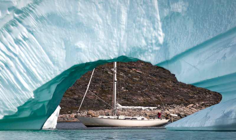
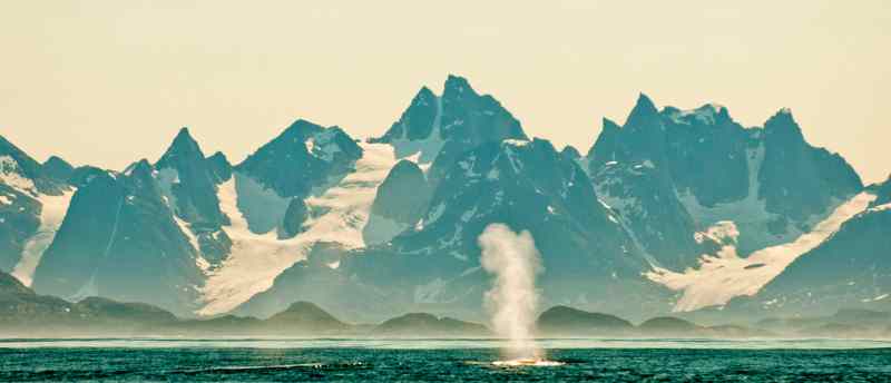
When the fog disappears, visibility on this coast seems limitless. We sailed westward to the Grønne Ejland with the intention to turn north there and go into Vaigat, a deep sound separating Disko Island from the mainland. The low islands drew a dark base to an endless line of gleaming icebergs resembling South Florida high-rises as seen from the Gulf Stream. We turned northward, bringing the ice to starboard and closer. The icebergs gained height and detail resembling crumbling castles, soaring cathedrals, l’Arc de Triomphe, leaning towers, the Tower of London — a photographer’s delight. I realized a bit later and with some shock that the bergs now crowded us from the port side. With the endless daylight, calm weather and working radar, we continued in the fairly open water taking one-hour watches. The lead channel kept narrowing until a tight barrier of bergy bits stretched right across the bow. We turned back and hoped to find an ice-free escape route. We couldn’t risk barging through even the softer brash ice with our vessel’s fiberglass hull.
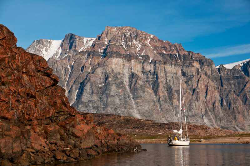
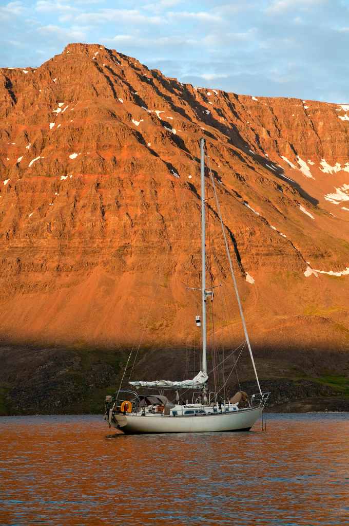
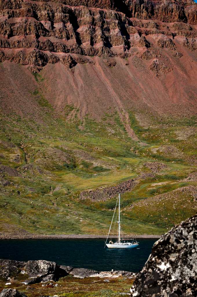
This unplanned retreat led to the south coast of Disko Island. The splendidly protected port of Old Godhavn, now Qeqertarsuaq, used to fill up with whaling ships. Today, small cruise ships send their guests ashore to patronize the whaling museum. Fortune Bay, which lies 4 miles away (and thankfully is too small for such ships), gave us a foretaste of Disko Island splendors. Frances B lay under the rampart of a mountain ridge of red rock. We slogged up the surprisingly green foreshore to check out small icebergs sailing offshore; they often tacked or rolled over while we looked. Channels of deep water separated us from husky-looking dogs dumped for the summer on the small islands to the west.
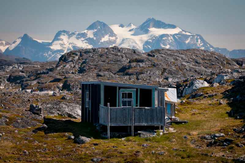
Several fjords cut into the west coast of Disko Island. The largest, Disko Fjord, branches into several arms. At the mouth of Kangerdluarssuk, a few homes have found a foothold looking like an elf lodge under an immense hulk of a headland. Across from our Akunaq Bay anchorage rose a long, steep range, furrowed as if it had crumpled in a head-on collision with a titanic tsunami. On the way along the west side of Disko Island and northward, endless sunlight flooded the sea from a clear July sky.
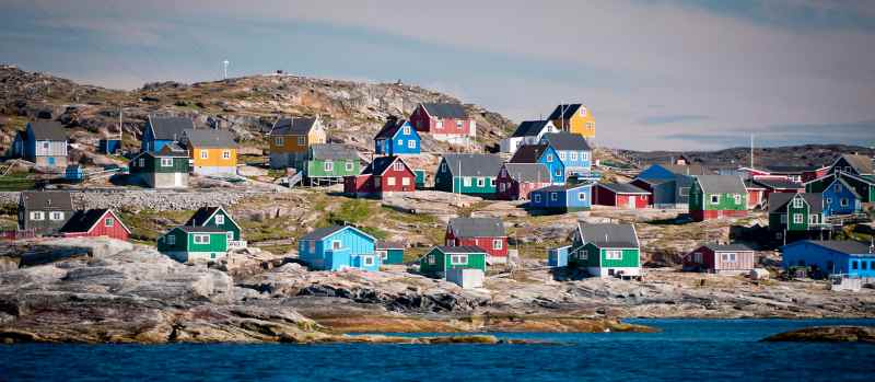
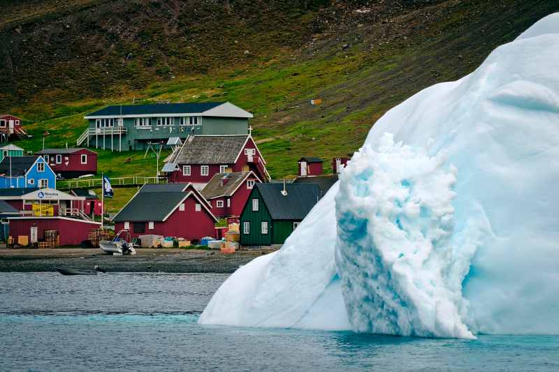
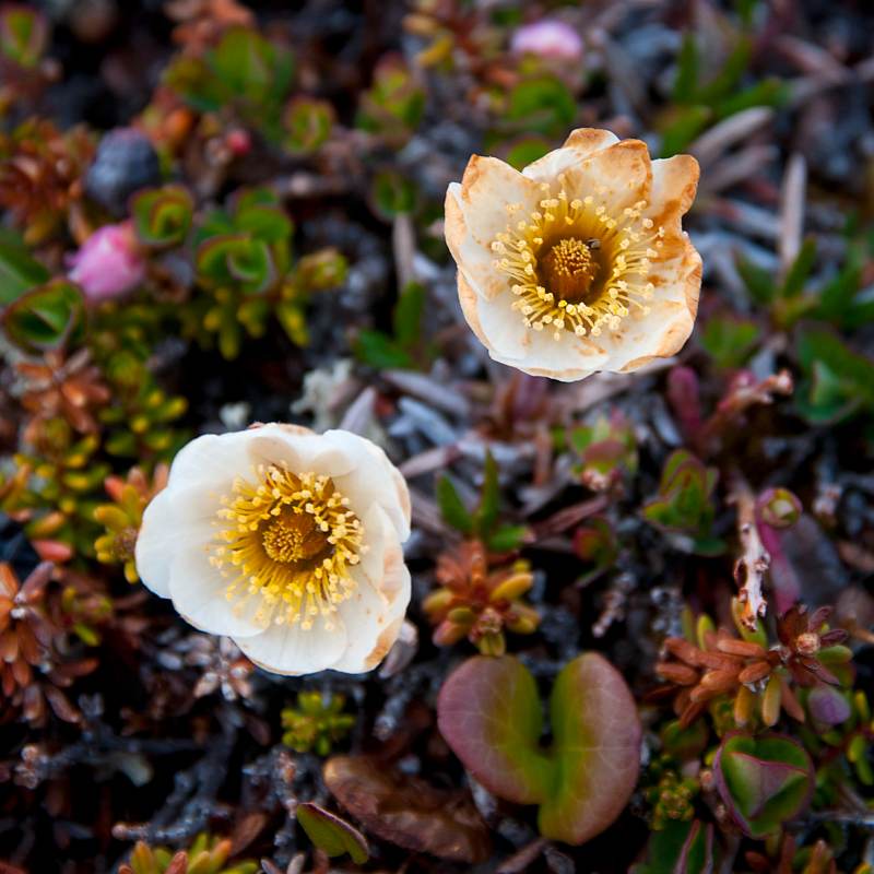
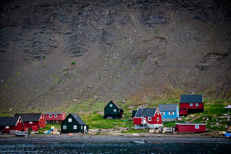
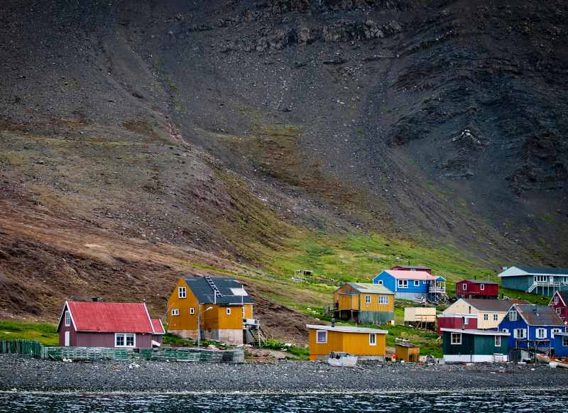
At Igdlorsuit, Kent’s home for a year, stood racks full of drying seal meat and salmon between the homes. Hunters were coming and going in skiffs, and the fish-processing plant hummed. Most old coastal villages have now turned ghostly with roofless house walls, empty gaping windows and wooden-boat carcasses sinking into grasses. Along the west coast people have moved to small towns, all 20 of them, which offer services and air connections to families — important on this roadless island covered by an ice cap and surrounded by icy waters and a coastline of 27,340 miles. Today, the old village sites indicate good harbors. On the way back south we sailed from the fog-bound, iceberg-filled southern Disko Bay to Kronprinsens Ejland and its abandoned village. While fog hovered outside, the sun shined so brightly I could count the cod swirling over the bottom.
Faeringhavn, once a large village on the ocean’s edge, was our last piece of Greenland. Frances B swung at anchor surrounded by islands and hills while a northwest gale tried, but failed, to force a gigantic wad of fog against the warm land. Some of the houses here still had padlocks on doors, and nets covered the wharf. A healthy trek over the hills revealed an iron sailing ship abandoned years ago. Nearby, a small waterfall of sweet water rushed by an empty lean-to sunk halfway into the turf.
At the beginning of August, we sailed to northern Labrador. Our 450-mile course cut through the waters of Davis Strait and crossed the tracks of Panther, a sailing ship the prominent American painter William Bradford chartered for his “art expedition to Greenland” in 1869. In Bradford’s seventh sailing trip to the north, he reached Greenland’s Melville Bay and somehow survived very heavy ice in Baffin Bay. So, clearly, we all need to read art history when casting about in search of the next voyaging adventure.
Navigating the North
Danish paper charts are a must. Get Willy Ker’s Faroe Iceland Greenland published by Imray and British Admiralty’s Arctic Pilot 3; Annie Hill’s blog Voyaging Notes gives sketches and details of several anchorages north of Uummannaq Fjord. Several digital chart systems cover Greenland, but they are unreliable off the main shipping routes. When it comes to Customs and Immigration, the harbor master in Nuuk calls for a visit aboard. In other harbors, stop in the police station for a passport stamp. When seeking a place to stay, pontoon “marinas” in Nuuk and other ports lie in shallow water and are filled tightly with small boats. Moor alongside other vessels or on open wharves. Large fenders are essential. All villages have diesel-dispensing floats. Payment is by credit card or Danish crown bank notes, often through ATMs. Yachts buying large quantities of fuel should call for a truck tanker and moor at the main wharves. From the end of June till mid-August is the best weather window to cruise the west coast of Greenland. Call Aasiaat Radio on VHF 16 to get a translation of the Danish forecast for your weather zone. SSB radio service often falters north of Nuuk. Even the satellite-based Iridium service can occasionally fail. Seamen’s houses in ports and some cafes ashore offer fee-based Internet connections.


