Lake Union Ship Canal, Seattle
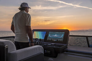
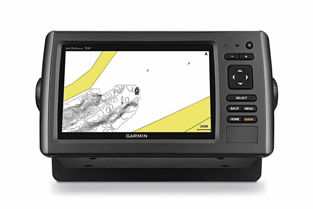
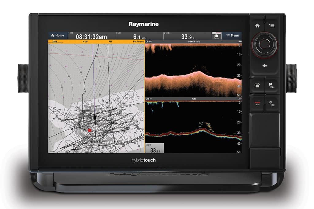
Sunlight battled washington state’s infamous cloud cover as Mark Tilschner’s Allied P21 carried us to a pocket of Puget Sound just east of Gedney Island. Tilschner works as Raymarine’s West Coast director of sales, so his ride was decked out with the latest kit, including a Raymarine eS128 multifunction display with Navionics Platinum Plus cartography.
As we cruised, contour lines around the boat became increasingly detailed. Navionics SonarChart Live used the vessel’s sounder to generate high-resolution, real-time bathymetry information. A few iPhone taps later and this data was transmitted to the Navionics cloud, where it was processed and eventually released as a new SonarChart.
Also, thanks to the Navionics Plotter Sync function and Raymarine’s operating system, we used the tethered iPhone’s cellular connectivity to download other cartography to the MFD, without a land-based Wi-Fi connection. Vector cartography has come so far, so fast.
HARNESSING DOPPLER
Advanced scanning and user-generated content aren’t the only recent innovations in marine electronics: Solid-state, Doppler-enabled radars also recently hit the market. These radars use the Doppler effect to determine whether a target is moving or in situ, as well as its threat level. Equipment depending, stationary objects and landmasses typically appear as regular radar imagery, while vessels moving faster than a threshold speed (ballpark 3 knots) are deemed targets. Approaching targets can be painted red, while nonthreatening or stationary targets can be painted green, giving users an instant visual on a target’s threat level.
Cartography from official sources, including the National Oceanic and Atmospheric Administration and other government offices, has helped guide mariners for centuries, but these charts require expensive and time-consuming survey work that is conducted irregularly. The lack of timely information can be problematic; some seafloors see hefty storm- and tidal-fueled geomorphic reconstruction. “Government sources are only as good as their data, and they’re not updating as often as they should,” says Dave Dunn, Garmin’s senior manager of marine sales and marketing.
Realizing the limitations of the government’s survey capabilities — and as a way to enhance user experiences — leading marine-electronics brands including Garmin, Navico (GoFree, Lowrance and Simrad) and Navionics recently started letting customers use their own sounder, GPS and networked MFD to record high-resolution bathymetry data to a microSD card. Users can bring their microSD card to a home computer and upload their sonar-log data to the cloud or use Wi-Fi-enabled MFDs at marinas.
Alternatively, Navico and Navionics both have built-in software features that let users pair their smartphone or cellular-enabled tablet with an MFD, so the chart plotter can uplink sonar-log data, as well as download charts, updates and routes.
For users, this trend means it’s getting easier to have accurate cartography on board your yacht. Once a user’s sonar-log data has been uploaded to the cloud, it’s processed and sometimes aggregated with other users’ data to create a high-resolution vector chart that participating customers can download.
“We have multiple contour options for Insight Genesis users,” says Steve
Mosinski, Navico’s global brand manager for GoFree, adding that users can download Insight Genesis cartography with 1-, 3- and 5-foot contour lines.
Garmin and Navionics also allow users to view their Quickdraw Contours and SonarChart Live data in real time on a contemporary Garmin or Raymarine MFD, respectively. This data is stored on a microSD card, where it can be shared with the cloud to become part of a user-generated chart, or a user can keep it private. Likewise, Navico’s Insight Genesis allows users to view their own bathymetry data as a chart layer that’s separate from other users’ sonar data.
While user-generated cartography, or UGC, is highly accurate, companies aren’t currently mixing it with official data. “The public is still a little skeptical of crowdsourced data, so we’re still keeping it church and state,” says Shaun Ruge, Navionics’ global product manager. Instead, UGC is presented as a layer atop an official chart (Garmin and Navionics) or as separate, non-aggregated layers of an individual user’s sonar data overlaid to create a composite chart (Navico).
Even with secular data, a common concern is that bad data could get into the aggregated pool, but all of the experts I spoke to said this has not been a problem. “Our [geographic information system] department at our Minneapolis office processes and quality-controls the data, ensuring that only clean data hits the [shared UGC] social layer,” Mosinski says.
Other manufacturers employ similar quality-control measures involving eyeballs and algorithms, and the boating community has proved adept at managing the data. “Policing is part of Quickdraw Community,” Dunn says of Garmin’s aggregated community layer. “We like to think that people wouldn’t intentionally [upload bad data], but it can be flagged and removed.”
While some anglers (incorrectly) fret that cartography companies secretly filch honey-hole secrets, all boaters can appreciate the auto-routing features on some C-MAP, Garmin and Navionics charts. Product depending, users can enter their vessel’s navigational parameters (i.e., draft and beam) and the cartography plots a safe route. In the case of Navionics’ Dock-to-Dock feature (currently available for iOS devices and Raymarine’s line of MFDs), the software can negotiate narrow channels and lead you directly to your slip — as I saw aboard Tilschner’s boat.
Moving forward, auto-routing and UGC will likely play larger roles as more boaters adopt the technologies. Also, the relationships between crowdsourced bathymetry and official data could evolve. “We’ve already mixed the data that Garmin has surveyed [using our fleet], but it might come to the point that we would incorporate [UGC],” Dunn says. “We’re not ruling it out.”
It will be interesting to see how long it takes before official sources start purchasing UGC-enabled chart kits and downloading their updates. Otherwise, they might find themselves waiting a long time for updated charts while boaters enjoy next-generation cartography.
SOUNDING THE SUBAQUATIC
Chirp transducers are great for helping to create high-resolution user-generated content, but their original intent was to let fishermen stalk their prey. More recently, leading marine-electronics companies have evolved these transducers to include side- and down-looking sonar, which help mariners to determine the bottom composition and clearly see whether they are passing over submerged structure or vegetation. Navico and Garmin independently developed networkable forward-looking sonar for collision avoidance and increased situational awareness, and Garmin has been making strides in multibeam scanning with its line of Panoptix transducers.