Skip to content
THE PRINCESS PASSPORT
Subscribe
Email Newsletter
Yachts
Yachts
Yacht Walkthroughs
Brokerage
Charter
Cruising
Cruising
Destinations
Electronics
Gear
Gear
Boating Safety
Marine Shop
Contact Us
Ultimate Boating Giveaway
Yachts
Brokerage
Charter
Cruising
Electronics
Gear
Newsletters
Giveaway
Shop
Yachts
Brokerage
Charter
Cruising
Electronics
Gear
Newsletters
Giveaway
Shop
SUBSCRIBE
SUBSCRIBE
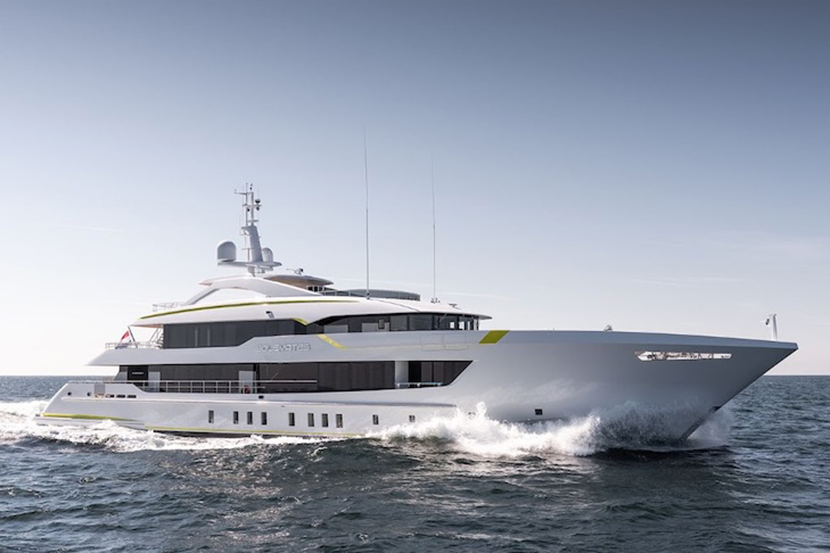
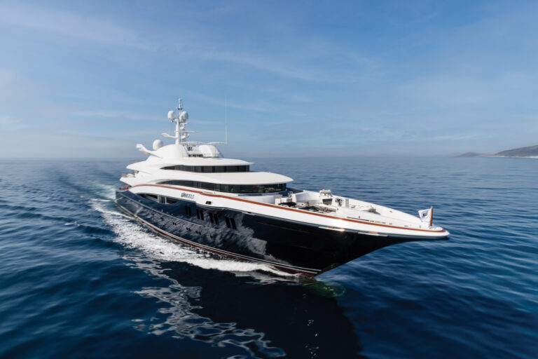
Heesen Delivers
Solemates
The 180-foot yacht has ‘significant customization,’ will debut at the Monaco Yacht Show this fall.
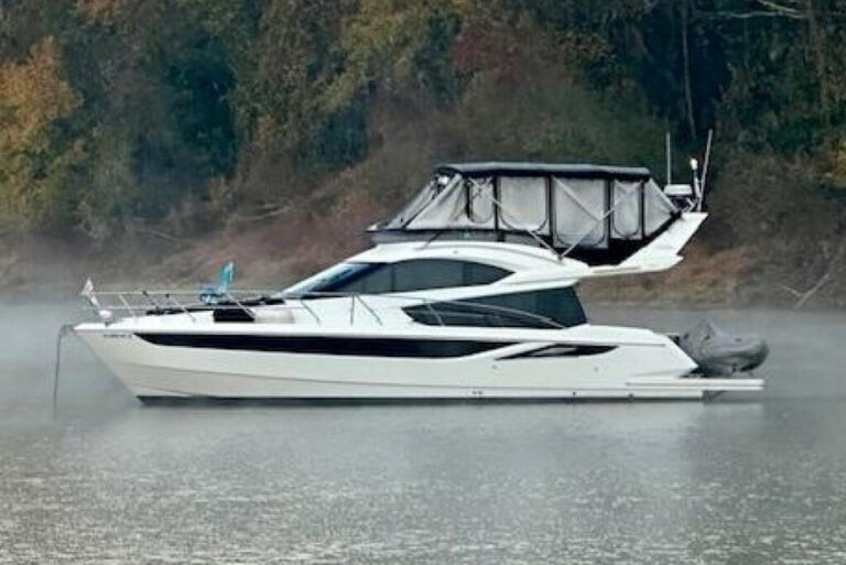
For Sale: Galeon 420 Fly
Bone Voyage
is powered by a pair of 435 hp Volvo Penta D6 engines, which give it a cruising speed of 16 knots and a top hop of 30 knots.
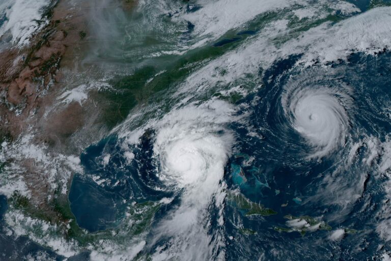
Understanding Hurricane Preparedness for Boat Owners
Learn essential tips for boat owners, including securing your vessel, choosing the right storage, and understanding insurance coverage.
For Sale: 2025 Princess Yachts F50 Flybridge
Twin Magic
has 33-knot speed, three staterooms and is asking $1.995 million.
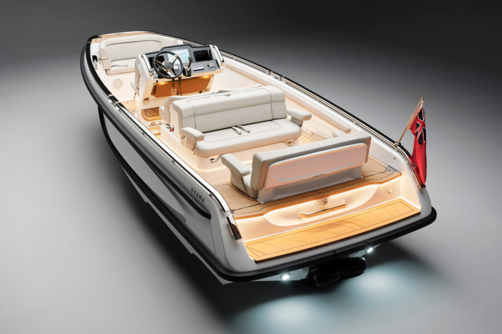
Evene Tenders Introduces the Origin Series
The new brand is designed for the superyacht market and includes two models in the Origin Series: a 5.7-meter Origin 57 and the 7.1-meter Origin 71.
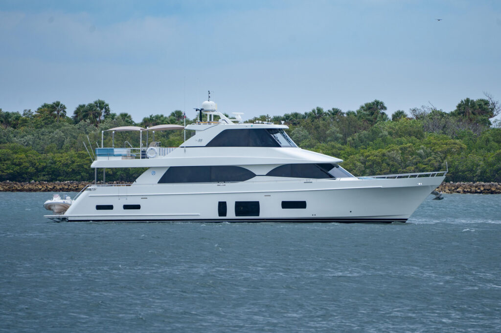
For Sale: 2006 Johnson 87 Pilothouse
Southern Belle
is Caterpillar-powered and ready to go, according to the broker, Gilman Yachts.
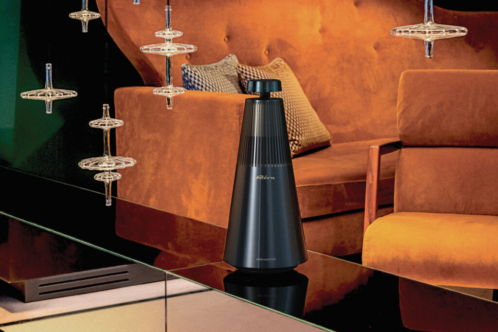
Riva's Yacht Speakers
Riva has teamed up with Bang & Olufsen to immerse the world of sound in Italian yachting style.
For Sale: Ocean Alexander 88 Motoryacht
With four staterooms including a full-beam master and a country kitchen layout, the 88-foot
Sanibella
is ready for new ownership.
Yacht Reviews
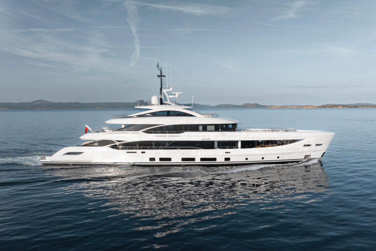
Benetti B.Now 50M Reviewed
Benetti's B.Now 50M is an ocean-crosser with 1,250 square feet of beach club and a private balcony off the master suite.
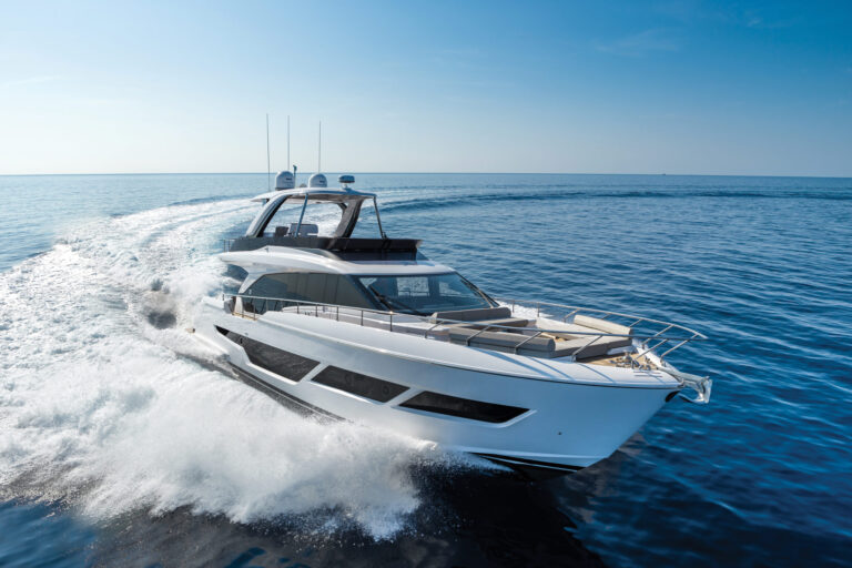
Ferretti Yachts 670 Reviewed
The three-stateroom, 32-knot Ferretti Yachts 670 is a stout and stylish cruising platform with several decor options.
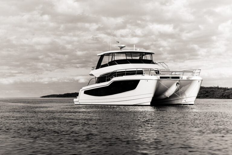
Aquila 50 Power Catamaran Reviewed
The Aquila 50 Yacht Power Catamaran offers homelike volumes, 21-knot speed and a nearly 2,000-nm cruising range.
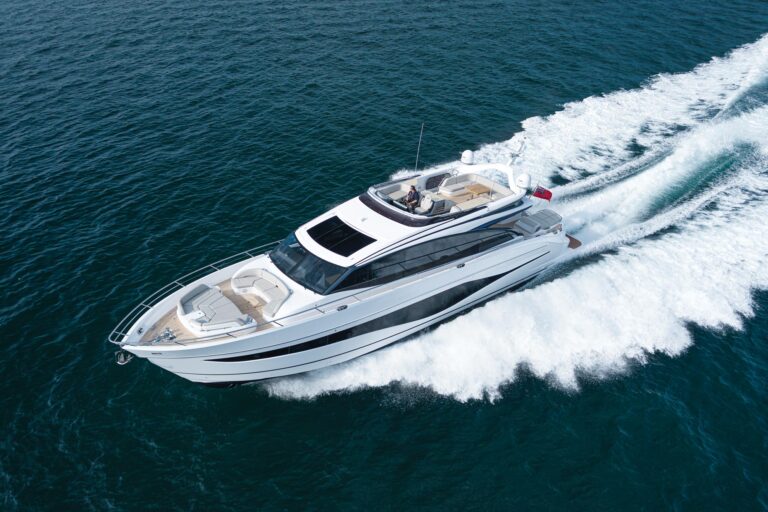
Princess Yachts S80 Reviewed
The sporty 35-knot Princess Yachts S80 has sleek lines, MAN diesels, and superyacht livability.
wallywhy100 Reviewed
The latest model in its semidisplacement series, the wallywhy100 seamlessly merges the interior and exterior zones.
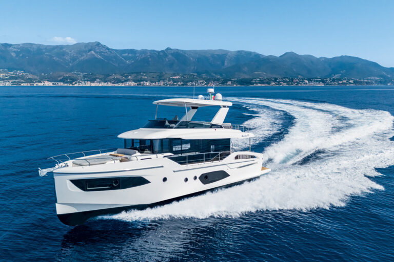
Absolute Navetta 53 Reviewed
Absolute's Navetta 53 packs equal parts style, function and performance, with design cues including vertical bridge windows.
Bluegame BGM75 Power Catamaran Reviewed
The Bluegame BGM75 blends forward-thinking design, strong performance and versatile layouts into a supersize power cat.
Regal 50 SAV Reviewed
Regal's 50 SAV embraces versatility, luxury and performance on the water in this outboard-powered sport-utility vessel.
Uniesse Exuma HTC5P Reviewed
The 56-foot Uniesse Exuma HTC5P has Italian style, luxe amenities and speed that tops 50 knots, thanks to its outboard power.
Yacht Reviews
Brokerage
For Sale: Galeon 420 Fly
Bone Voyage
is powered by a pair of 435 hp Volvo Penta D6 engines, which give it a cruising speed of 16 knots and a top hop of 30 knots.
For Sale: 2025 Princess Yachts F50 Flybridge
Twin Magic
has 33-knot speed, three staterooms and is asking $1.995 million.
For Sale: 2006 Johnson 87 Pilothouse
Southern Belle
is Caterpillar-powered and ready to go, according to the broker, Gilman Yachts.
For Sale: Ocean Alexander 88 Motoryacht
With four staterooms including a full-beam master and a country kitchen layout, the 88-foot
Sanibella
is ready for new ownership.
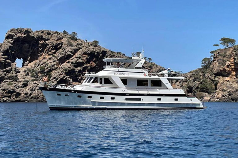
For Sale: 2005 Grand Alaskan 65 Flush Deck
The three-stateroom motoryacht
Bochinche
has Caterpillar C-12 diesels, a 12-knot cruise speed and is asking $1.4 million.
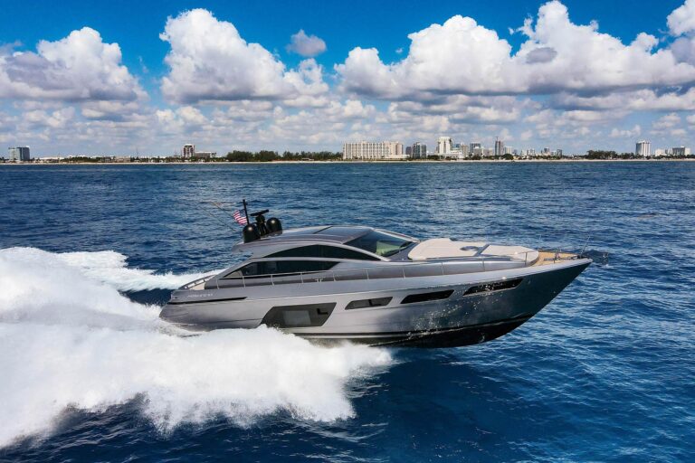
For Sale: Pershing 6X
Known for its performance as well as its luxury, the 6X from Pershing boasts a top hop of 48 knots.
Brokerage
Electronics
Helm Upgrades With FLIR And Garmin
FLIR and Garmin each unveil helm-tech tools to help skippers enhance situational awareness.
FarSounder's Argos Collision-Avoidance System Reviewed
Custom software and firmware make collision avoidance and navigation possible, while bespoke hardware makes it feasible.
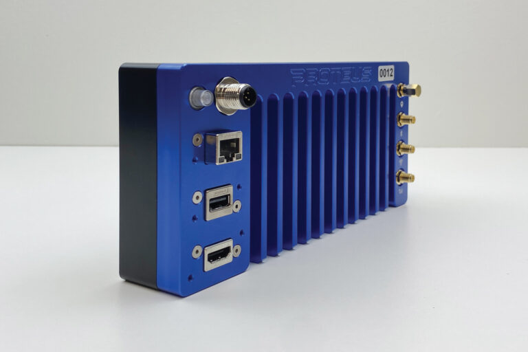
Smart Navigation with Tocaro Blue's Proteus Hub
Tocaro Blue’s Proteus system uses machine learning to demystify radar returns and help prevent collisions at sea.
Electronics
Charters
Florida and Bahamas Yacht Charter Options
Several yachts are promoting availability for getaways in the Abacos, Exumas and beyond.
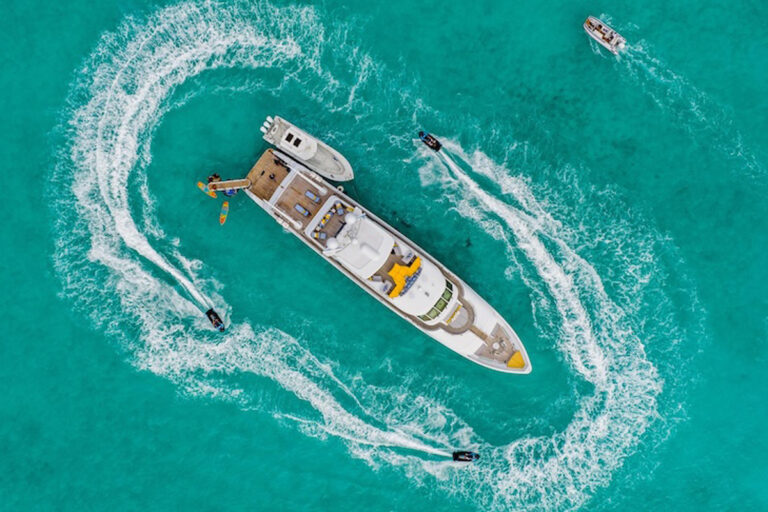
Wheels
Wins Big at Antigua Charter Yacht Show
This crew turned heads at the annual industry-only boat show, winning first place in the food and decorating competitions.
Classic Cool Charter Yachts
These older vessels are offering charter experiences that make them standout options, even among newer builds.
Charters
Destinations
Cruising Sardinia
Yacht owners set a course to see and be seen in Sardinia, this international hotspot off Italy’s mainland coast.
Palm Beach Marina Gets Upgrade
This popular destination on Florida's busy southeastern coast has enhanced transient space for visiting boaters.
Cruising Corsica
The natural wonders of Corsica, the island of Napoleon's birth, win over Mediterranean cruisers year after year.
Cruising Nova Scotia
Known as "Canada's Festival Province," Nova Scotia is a natural base for any cruising itinerary in the Canadian Maritimes.
Aqua Expeditions Charters to the Seychelles and Zanzibar
Aqua Expeditions is now offering luxury charters in the remote outer islands of the Seychelles and Zanzibar in East Africa.
Cruising Port Townsend, Washington
Port Townsend, Washington, wins over visiting yachtsmen with its historic Victorian architecture and delectable dining scene.
Destination St. Thomas
This gateway to the US Virgin Islands is a stellar jumping-off point for Caribbean cruisers of all skill levels.
St. Simons Island, Georgia, is a Coastal Cruising Gem
Part of Georgia's Golden Isles, this waypoint combines a beach lifestyle with golf, restaurants, boutiques and more.
Habacoa: The Bahamas’ Newest Superyacht Marina and Community
The project will include accommodations for yachts up to 700 feet length overall as well as a 200-vessel dry stack facility.
Destinations
Gear
Riva's Yacht Speakers
Riva has teamed up with Bang & Olufsen to immerse the world of sound in Italian yachting style.
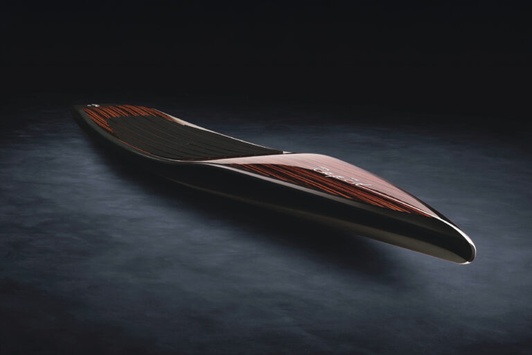
Beau Lake Paddleboards
Paul Lavoie and the team at Beau Lake thinks stand-up paddleboards should be just as beautiful as everything else on board.
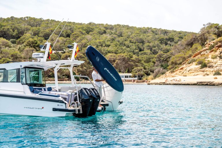
The Adventure Collection from Axopar and Jobe Watersports
A new collection of watersports toys and gear designed for on-the-water fun from boatbuilder Axopar and Jobe Watersports.
Supersede's Marine Plywood Alternative
Supersede’s Marine Board, a replacement for marine-grade plywood, provides a greener way of building and refitting yachts.
Gear