Jorge Pecci is a Master Mariner, LLM in Maritime Law, Associate Fellow of the Nautical Institute, and CEO of SafeWaters Underwriting Managers
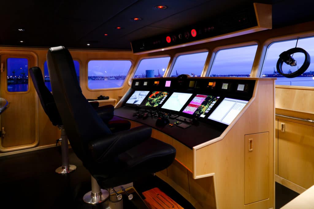
Despite all the modern equipment onboard today, safely navigating your yacht, still relies on the human element, making the role of the navigator extremely important. Today’s yachts are equipped with integrated, advanced navigational and communication technology designed to improve navigational safety. However, collisions, groundings, and other navigation-related accidents continue to happen, sometimes involving loss of life or damage to the marine environment.
Contributing Factors to Safety at Sea
There are many factors that play a role in the safety at sea. Some of these are caused by the human elements, some by the sheer increase in the number of boats on the water, and some by industry and environmental changes. Human factors can include complacency, fatigue, and even an overload of information. Too many accidents are caused by the person on watch simply not looking out the window regularly or not being familiar with the equipment he or she is operating.
Navigational waters and the world fleet are continuously changing, making navigation much more complex than in prior years. The world fleet number has tripled since 1980, leading to an increase in the number of ship-to-ship encounters and collision-related risks. In addition, vessel sizes have increased. Bigger ships need larger spaces and longer times to maneuver. This reality, combined with the larger draft of such vessels, creates an additional challenge when operating in coastal/shallower waters.
Different industries are also making an impact on traffic density and creating their own potential hazards. Oil and gas exploration has greatly increased since the mid-70s and has moved further offshore, leading to an increase in the supply/support vessels required. Navigators need to be aware and keep a pulse on how this impacts their sailing strategy. Similarly, there is a substantial increase in offshore windfarms, which reduce available space for through traffic and increase the risk of collision/grounding.
The establishment of Environmentally Sensitive Sea Area (ESSA) and Particularly Sensitive Sea Area (PSSA) by the International Maritime Organization (IMO) also impact a navigator’s sailing strategy. Ships are required to avoid certain sea areas that need special protection, ultimately concentrating traffic in other areas.
What We Know Works
Understanding that the safe navigation of the yacht must always be the main priority of the skipper above all else helps mitigate many risks. Often, the skipper is under real or perceived outside pressure, whether to arrive at a port in time, to make a tide, or to preserve the vessel’s itinerary. Due to this pressure, the captain may take unacceptable risks by cutting corners or not proceeding at a safe speed in areas of high traffic density or restricted visibility.
Also, it is paramount for the skipper or a dedicated crew member keep a good lookout at all times. Rule 5 of the Colregs states, “Every vessel shall at all times maintain a proper lookout by sight and hearing as well as by all available means appropriate in the prevailing circumstances and conditions so as to make a full appraisal of the situation and of the risk of collision.” All those involved in yacht navigation must use all available means to gather information, be aware of their own strengths and weaknesses, and know when to call upon the skipper.
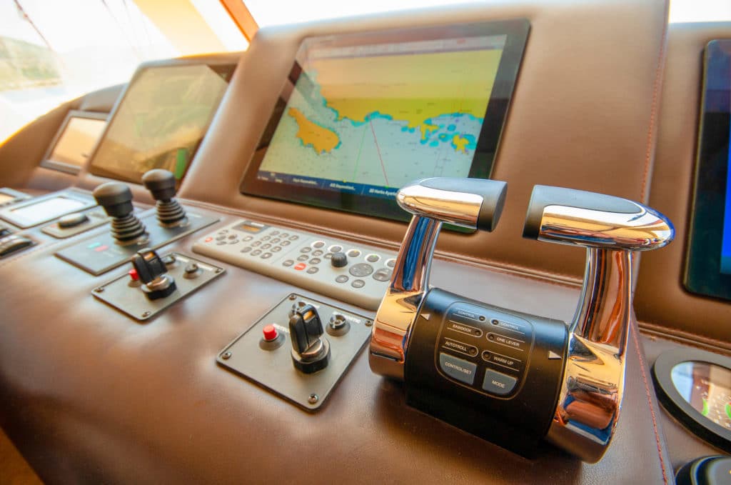
Using navigational tools effectively also helps mitigate risks. This includes both reviewing electronic navigational tools and being aware of one’s surroundings. Full use of radar ranges and bearings, visual bearings, and transits should also be made as a primary means of fixing the vessel’s position. GPS is an invaluable aid to navigation. However, the exclusive use of GPS in coastal or confined waters is often a contributory factor in ship groundings.
Of course, too much information is as dangerous as too little, so it is important to maintain the distinct functions of the Electronic charts, radar, and other navigation aids. Electronics (including ECDIS) are not always used properly. In particular, overlaying the display with radar imagery, AIS, and other navigational input may clutter the display and cause difficulty in assessing the information.
Today, we are fortunate to have three totally different ways of detecting targets: sight, radar, and AIS. True correlation of all three techniques on all targets of interest is ideal. The correlation between the optical view and the equipment displays is essential in identifying targets of interest undetected by the radar and AIS. Obviously, in poor visual conditions, a much more cautious approach to potential dangers is essential.
Be Prepared and Alert
Unnecessary or persistent bridge system alarms are disrupting to say the least, and an alarm that sounds frequently may lead to it being incorrectly disabled, causing it to not sound when needed. Setting the alarms properly and knowing your equipment is crucial to avoiding such a situation.
When visiting a new area or a destination that you have not been to for some time, consider using more than one chart, if available. No chart is perfect, and the seas change faster than the weather. Some chart providers offer crowd sourcing for more up-to-date data, but user-generated content can be prone to human error.
Have a backup plan. The person in charge at the bridge needs multiple methods of navigation reference. If your main system stops working unexpectedly or you need more portability than a traditional chart plotter, a great backup is mobile apps on your smartphone or tablet. You can get inexpensive yet powerful chart navigation apps and separately downloaded charts of waters anywhere in the world.
Don’t let apparently benign conditions lull you into a false sense of safety. Just because the ECDIS shows you to be on track and there’s nothing significant on the radar or visually appearing through the bridge window doesn’t mean you should relax. In reality, if your positioning system is providing erroneous information, you may be a few miles off, perhaps approaching an imminent grounding. Finally, don’t forget the growing possibilities of false information being displayed on navigation equipment through cyber-crime.
Minimizing the Risk of a Cyber-Attack
Cyber-crime is a growing threat that affects everyone, including the maritime industry. There are several things to consider to mitigate your risk. First, install a system that blocks attacks both internally, through plugged-in USB devices, and externally, from data that is delivered from an external source to your yacht. Make sure you update your ECDIS’s operating system. If it is out of date and no longer getting security patches, it’s time to upgrade. Use cyber-secured USB ports that encrypt the data and have built-in virus protection. There are market-available military grade encryptions, ensuring a secure data exchange on the bridge. Also, secure your passwords. Don’t give a hacker admin privileges across your entire on-board network. Finally, it is good practice to download encrypted chart updates onto a USB drive, check it on a remote PC for malware and viruses, and then upload the updated charts. For further details, refer to Cyber Security on Board Ships (International Union of Marine Insurers) and USCG Cyber Strategy.
Why SafeWaters
SafeWaters develops tailor-made solutions to the Marine space through a group of highly talented industry professionals with knowledge beyond the traditional underwriting level. This expertise comes with actual shipping/engineering/claims hands-on experience, allowing the SafeWaters team to better understand the needs of our customer and to develop solutions accordingly.
Take the next step: safewatersmarine.com