_(__Chart courtesy of NOAA)_
Known as a top tourist attraction for its wealth of American history, Plymouth, Massachusetts is also one of New England’s finest ports for cruising yachtsmen. If you thought this iconic New England town was mostly for school kids taking class trips to see where the Mayflower landed, you may be surprised to discover how much else Plymouth has to offer.
After a relaxing few days hanging out doing much of nothing on Block Island and then exploring our favorite Eastern Long Island haunts, we head towards Buzzards Bay light, a 60-mile passage from Greenport, NY. Never to be taken lightly, this route includes crossing Block Island Sound, which can be a challenge in a heavy blow. Today we experience three-to-four foot beam seas on top of gentle ocean swells, conditions that are within the comfort zone of our seaworthy vessel.
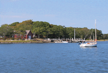
Soon after passing Buzzard’s Bay light, we see Cuttyhunk off to our starboard, and we decide to stop here overnight. Keeping the red nuns and Pease Ledge to starboard, we negotiate Cuttyhunk’s harbor jetty and pick up a mooring for the night. Dinner onboard and a walk around the quaint, unpretentious inner harbor bring a peaceful close to an active day on the water.
Early the next morning we continue up Buzzard’s Bay. A stiff southwesterly breeze and an opposing current can create miserable conditions on the Bay, but today the conditions make for a pleasant run. Along the way, we stop at Wood’s Hole to visit the National Fisheries Aquarium and the Oceanographic Institution. Entering the harbor, we pay close attention to the marks, as things can get confusing in this narrow, rock strewn passage very quickly, especially if the current is near its maximum flow of 5 knots or more. After our educational tours and a quick lunch at Quicks Hole, we’ll head back out to Buzzard’s Bay. _(Click here for more about our visit to Cuttyhunk and Woods Hole.)_
Arriving at the southern end of Cape Cod Canal by late afternoon, we benefit from a flood tide giving us a 4-knot boost. It’s a 10-mile stretch between Cedar Point and Cape Cod Bay, and with a 10-mph speed limit and no-wake zones it takes a little over an hour to transit the canal.
We now run northwest 15 miles to the entrance of Plymouth Harbor where we round the long finger of Plymouth Beach and follow it until the channel makes a hard turn to starboard. Looking at the chart of dogleg turns around a maze of sand bars, it’s no small wonder that the Mayflower found its way into the harbor without mishap.
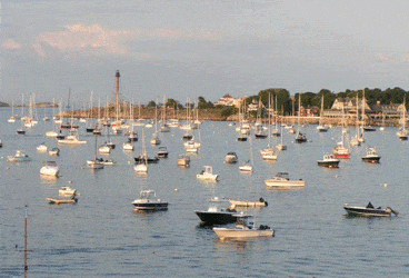
Today, however, we need to dodge the maze of lobster pots that are everywhere – a sure sign that we’re in New England waters. We soon pass the breakwater and enter the inner harbor, where we pick up a mooring rented by the Plymouth Yacht Club. The Club provides launch service, and there is also a public dinghy dock at the Town Wharf. While there are over 600 moorings available, anchoring in this busy inner harbor is prohibited. There is, however, a protected area to drop the hook along an unmarked channel parallel and south of the main channel. Transient slips, fuel and a pump out can be found at Brewer Plymouth Marine, located just north of the Yacht Club.
As we watch the sun go down in our cockpit, we are struck by the historic scene along the shoreline. Standing tall is the rigging of the Mayflower II, a full size replica of the original Pilgrim ship. Next to it is Pilgrim Memorial, where Plymouth Rock , the surprisingly small boulder itself, is located. Part historical fact, part myth, the rock now sits close to where the original settlement was built and is off-limits to souvenir hunters.
After an early evening walk along Water Street and Pilgrim Memorial State Park, we’ll stop at the Blue Eyed Crab Grille for a bowl of chowder and a lobster roll, wondering if we could ever get tired of New England seafood. Continuing our walk along the waterfront, we are drawn to a gathering of several hundred folks setting up lawn chairs and laying down blankets. We discover we are about to enjoy one of the many free summer concerts offered by Project Arts of Plymouth. Started in the late 90s, this series of concerts now draws thousands of music lovers each week.
We start the next morning with a requisite tour of Mayflower II. Built in England and having crossed the Atlantic in 1957, the 106-foot ship underwent an extensive refit during this past winter at Fairhaven Shipyard. As anyone who has owned a wooden boat will tell you, the yard soon discovered many more problems than were initially suspected. But thanks to generous donor gifts and the tenacity of the Plimouth Plantation (part of the Smithsonian Institution Affiliates Program), the ship has been restored to its glory and in 2020 will participate in the 400-year anniversary celebration of the Pilgrims’ voyage.
While the Mayflower II is smaller than we had expected (especially considering that it carried over 100 Pilgrims during its epic voyage), we are really surprised to see how miniscule Plymouth Rock is. This world famous symbol of courage and freedom is on display in a granite monument located in Pilgrim Memorial State Park. We are among the nearly one million visitors who come here annually to get a look at where the Pilgrims set foot upon the new world.
Continuing our immersion in American history, we’ll hop on the town trolley for a short ride to Plimouth Plantation, the 100-acre recreation of a 17th century settlement complete with costumed interpreters and modern day artisans. We travel back in time as we listen to the interpreters tell us their unique stories of how they lived, worked and interacted with Native Americans. During our 2-hour self-guided tour, we’ll see homes, gardens, storehouses and fortifications that have been faithfully recreated, and we learn more about our nation’s very first Thanksgiving.
Among the area’s most popular attractions are its beautiful, sandy beaches, so we head to Plymouth Long Beach with our beach towels, sun lotion and summer novel. The beach is a popular gathering place for thousands of shorebirds, which seem eager to pose for a group of photography students lugging their tripods and long lenses along the three-mile stretch of sand.
On the way back to our boat we stop along the Town Wharf where the commercial fleet has already unloaded its fresh catch of the day. The cod, haddock, striped bass, lobster and clams don’t have to travel far as there are at least six seafood restaurants within walking distance. We’ll pick the East Bay Grille for a light dinner, where we’ll recap our busy day of historical tours, sightseeing and beachcombing.
Plymouth has earned its name, “America’s Hometown,” by reminding us of our historical roots, celebrating our traditions and commemorating the courage of those who first landed on our shores. Today, this friendly, captivating seaside town has become a favorite destination of yachtsmen with an interest in history and an appreciation of New England charm. For those cruising with children, it’s a must stop.
_Check out our virtual vessel’s high tech helm._
Five Stops Along The Way
****_As we head north to New England from our homeport of Annapolis, we’ll be highlighting some of our favorites places to stop as well as key passages along the way. _
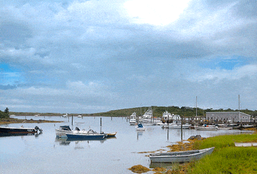
Cuttyhunk 41° 25′ 32″ N 70° 55′ 44″ W
The first of the Elizabethan Islands on our way north, Cuttyhunk is a Native American word for “lands end.” It has a much more remote and primitive feeling than fashionable Martha’s Vineyard or Nantucket, which are further east across Vineyard Sound. We follow the marks carefully, staying clear of Pease Ledge, to enter Cuttyhunk Pond, where we pick up a mooring marked “Town of Gosnold.” Shallow draft vessels may find a slip at at the town dock. In calm weather we’ve anchored for a short time in the outer harbor west of Pease Ledge. A walk up the hill from the town dock brings us to a market, a gift shop, town hall and library – all very small and quaint. For dinner, we’ll order lobsters-to-go at the Fish Market on the Town Dock. Next morning, we enjoy breakfast and a beautiful view on the veranda at the Cuttyhunk Fishing Club B&B. Afterwards, we visit the little Museum of the Elizabeth Islands before heading north up Buzzard’s Bay.
Woods Hole 41° 31′ 37″ N 70° 40′ 23″ W
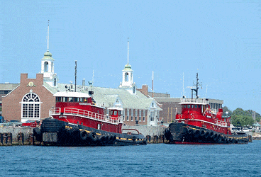
We’ll stop for lunch in this salty little village where fishermen, yachtsmen, scientists and tourists gather to work and play. Entering the harbor from Buzzards Bay, we pay close attention to the marks and our chart. Because the buoys run from Vineyard Sound through the harbor to Buzzard’s Bay, the red nuns are on our port side. Making matters even more challenging, the current is running more than 5-knots. We’ll drop our hook in the northwest corner of Great Harbor and take our dinghy to the landing on Eel Pond. From here we walk to the Woods Hole Oceanographic Institution (WHOI) Exhibit Center where we learn about the fascinating research vessels used to study our oceans. We also check out the exhibits at Woods Hole Science Aquarium, part of the Northeast Fisheries Science Center, before grabbing lunch at Quicks Hole, where the lobster tacos live up to their reputation.
Cape Cod Canal 41° 46′ 11″ N 70° 34′ 22″ W
Transiting this seven-mile, north-south cut across Cape Cod saves us from having to negotiate tricky Nantucket Shoals and another 40 miles offshore around the Cape – overall a savings of 80 miles on our route to Plymouth. Currents in the canal range from 3.5 to 6 knots, so it’s a good idea to check the tide tables before approaching the entrance. Although there is usually a lot of commercial traffic, staying to the starboard side of the 480-foot wide channel will keep you out of harms way. Anchoring, turning around or sailing in the canal is prohibited, and the entire canal is a no-wake zone with a 10-mph speed limit. Two fixed highway bridges have vertical clearances of 135-feet, and there is one railroad lift bridge that is almost always in the open position.
Marblehead, MA 42° 30′ 05″ N 70° 50′ 56″ W
Located 17-miles north of Boston Harbor, Marblehead is the quintessential New England seaside community. With its attractive, natural harbor, historic architecture and charming downtown area, it has been a favorite stop for cruising yachtsmen for over a hundred years. Dubbed the Yachting Capital of America, it has been home for a number of famous racing yachts. Anchoring in the crowded harbor is a challenge, so we call the harbormaster on our VHF and are directed to a town mooring. After lunch at The Landing, we visit the Marblehead Museum, where we learn about the town’s role during the Civil War. Luckily it’s Saturday night, so we enjoy Marblehead’s Summer Jazz performance held at the Unitarian-Universalist Church on Mumford Street.
Portsmouth, NH 43° 03′ 29″ N 70° 43′ 35″ W
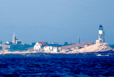
On our way north from Marblehead, we’ll first stop at the wind swept Isles of Shoals and pick up a mooring in Gosport Harbor for the afternoon. We land our dinghy on unpopulated Smuttynose Island and take a self-guided walking tour of the historic island, learning about the infamous murders of two young women in 1873. Because the weather forecast is for a late afternoon thunderstorm, we make the quick, 6-mile run back to the mainland and get a slip at Wentworth Marina in Little Harbor, just south of Portsmouth Harbor. This first class facility has it all, and we decide to stay here for a couple of days to take advantage of its resort-like amenities including a pool, tennis courts and use of a courtesy car to visit nearby Portsmouth. Named one of “America’s Prettiest Towns” by Forbes magazine, we enjoy Portsmouth’s sidewalk cafes, art galleries, unique shops and historic museums.